|
search place name
|
||
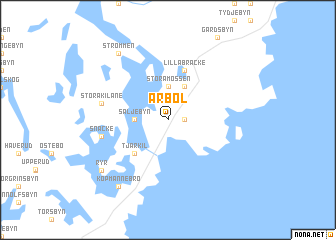
Årbol ((( Älvsborg )), Sweden)Årbol is a town in the (( Älvsborg )) region of Sweden. An overview map of the region around Årbol is displayed below.
regional and 3d topo map of Årbol, Sweden ::
Årbol airports ::
The nearest airport is LDK - Lidkoping, located 56.1 km south east of Årbol.
Other airports nearby include THN - Trollhattan Vanersborg (60.4 km south), KVB - Skovde (93.5 km south east), KSK - Karlskoga (124.4 km north east), GSE - Gothenborg Save (126.2 km south), Nearby towns ::
Ylingebol (1.0km east) //
Stora Mossen (3.7km north) //
Säljebyn (1.9km west) //
Lilla Mossen (3.8km north) //
Ånimskog (3.8km north) //
Tjärkil (4.2km south west) //
Lilla Bräcke (5.6km north) //
Stora Kilane (4.3km north west) //
Snäcke (4.3km south west) //
Strömmen (8.0km north) //
Köpmannebro (8.0km south) //
Ryr (6.8km south west) //
[all distances 'as the bird flies' and approximate] 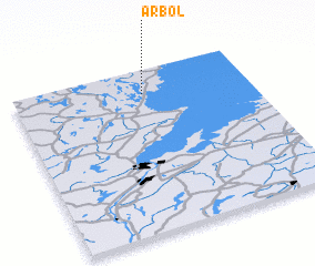 Places with similar names to Årbol, Sweden ::
Disclaimer :: Information on this page comes without warranty of any kind |
||
|
Where is Årbol? Elevation and coordinates ::
Latitude (lat): 58°51'0"N Longitude (lon): 12°33'0"E
Elevation (approx.): 57m (map arrows pan, magnifying glasses zoom) |
||
|
Visiting Årbol? Hotel/Accommodation ::
Book a hotel in Årbol Travel Guide ::
Buy a travel guide for Sweden rental cars ::
car rental offers GPS waypoint ::
download a GPX waypoint (PoI) of Årbol for your GPS receiver
|
||