|
search place name
|
||
Åsared ((( Älvsborg )), Sweden)Åsared is a town in the (( Älvsborg )) region of Sweden. An overview map of the region around Åsared is displayed below.
regional and 3d topo map of Åsared, Sweden ::

Åsared airports ::
The nearest airport is JKG - Joenkoeping Jonkoping, located 14.2 km south of Åsared.
Other airports nearby include KVB - Skovde (63.9 km north), LDK - Lidkoping (82.2 km north west), GOT - Gothenborg Landvetter (107.2 km west), THN - Trollhattan Vanersborg (110.7 km north west), Nearby towns ::
Habo (4.2km north east) //
Gäbo (5.6km north) //
Ebbarpsby (3.5km south east) //
Kivarp (5.6km north) //
Dykärr (5.6km north) //
Svinhaga (5.9km south) //
Fiskebäck (3.9km east) //
Gustav Adolf (7.5km north) //
Apelskift (5.4km south west) //
Granshult (5.4km south east) //
Luktenborg (7.7km north) //
Älgafall (8.0km south) //
Somneryd (8.4km north west) //
Simonstorp (8.4km north east) //
[all distances 'as the bird flies' and approximate] 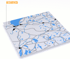 Places with similar names to Åsared, Sweden ::
// Aouzert (MA)
// Aouzert (MA)
// Azrou Ouado (MA)
// Ausserroid (AT)
// Acereto (IT)
// Az Zārāt (TN)
// Acered (ES)
// Acereda (ES)
// Asarta (ES)
// Azrat (IR)
Disclaimer :: Information on this page comes without warranty of any kind |
||
|
Where is Åsared? Elevation and coordinates ::
Latitude (lat): 57°53'0"N Longitude (lon): 14°2'0"E
Elevation (approx.): 207m (map arrows pan, magnifying glasses zoom) |
||
|
Visiting Åsared? Hotel/Accommodation ::
Book a hotel in Åsared Travel Guide ::
Buy a travel guide for Sweden rental cars ::
car rental offers GPS waypoint ::
download a GPX waypoint (PoI) of Åsared for your GPS receiver
|
||