|
search place name
|
||
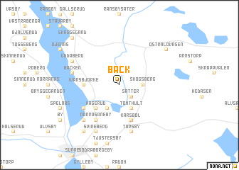
Bäck (Värmland, Sweden)Bäck is a town in the Värmland region of Sweden. An overview map of the region around Bäck is displayed below.
regional and 3d topo map of Bäck, Sweden ::
Bäck airports ::
The nearest airport is KSK - Karlskoga, located 97.4 km south east of Bäck.
Other airports nearby include ORB - Orebro (129.8 km south east), MXX - Mora (134.6 km north east), LDK - Lidkoping (163.5 km south), KVB - Skovde (170.1 km south), Nearby towns ::
Sätter (2.1km south east) //
Östanbjörke (2.1km south east) //
Skogsberg (1.9km east) //
Sätterstad (1.9km east) //
Tomthult (3.8km south) //
Ivarsbjörke (3.9km south) //
Hägerud (4.1km south west) //
Ivarsbjörke (2.8km west) //
Gjutaregården (5.6km south) //
Karsbol (5.7km south) //
Edsbjörke (4.6km south west) //
Norra Såneby (5.9km south) //
Torsby (7.5km south) //
Bäcken (4.1km north west) //
Norra Borgeby (6.2km south west) //
Askerud (6.2km south west) //
Svineberg (7.6km south) //
Backa (7.6km south) //
Östra Kårud (5.2km north west) //
Solberg (5.2km north west) //
Uddaberg (5.2km north west) //
Norra Arneby (7.9km south) //
Gunnarsby (7.9km south) //
Östra Lövåsen (6.7km north east) //
Backa (8.3km north west) //
Åsegård (8.3km north west) //
Skäggegård (8.3km north west) //
[all distances 'as the bird flies' and approximate] 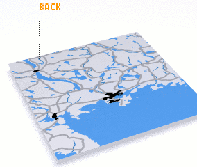 Places with similar names to Bäck, Sweden ::
Disclaimer :: Information on this page comes without warranty of any kind |
||
|
Where is Bäck? Elevation and coordinates ::
Latitude (lat): 59°56'0"N Longitude (lon): 13°13'0"E
Elevation (approx.): 84m (map arrows pan, magnifying glasses zoom) |
||
|
Visiting Bäck? Hotel/Accommodation ::
Book a hotel in Bäck Travel Guide ::
Buy a travel guide for Sweden rental cars ::
car rental offers GPS waypoint ::
download a GPX waypoint (PoI) of Bäck for your GPS receiver
|
||