|
search place name
|
||
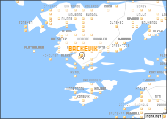
Bäckevik ((( Älvsborg )), Sweden)Bäckevik is a town in the (( Älvsborg )) region of Sweden. An overview map of the region around Bäckevik is displayed below.
regional and 3d topo map of Bäckevik, Sweden ::
Bäckevik airports ::
The nearest airport is GSE - Gothenborg Save, located 25.3 km south east of Bäckevik.
Other airports nearby include GOT - Gothenborg Landvetter (51.5 km south east), THN - Trollhattan Vanersborg (60.1 km north east), LDK - Lidkoping (108.9 km north east), AAL - Aalborg (141.8 km south west), Nearby towns ::
Källdalen (0.7km north west) //
Båtevik (1.3km south) //
Tolleby (1.9km north) //
Mölnebo (1.0km east) //
Kårevik (1.9km south) //
Stansvik (1.4km south west) //
Hålan (1.4km south east) //
Aröd (2.1km north west) //
Kuballe (2.1km north east) //
Olsby (2.1km north east) //
Rönnäng (2.1km south west) //
Stora Dyrön (2.1km south east) //
Morik (2.4km north west) //
Kebene (3.7km north) //
Bleket (2.0km west) //
Häle (3.8km north) //
Tyfta (2.7km north east) //
Åstol (3.8km south) //
Kroksdal (4.2km north west) //
Budalen (4.2km north east) //
Grinneröd (5.6km north) //
Stockevik (3.5km north west) //
Sibräcka (5.6km north) //
Krossekärr (5.6km north) //
Stenkyrka (5.6km north) //
Gåre (3.5km north east) //
Knarrevik (3.5km north east) //
Backudden (5.6km south) //
Rånäs (4.1km north west) //
[all distances 'as the bird flies' and approximate] 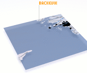 Places with similar names to Bäckevik, Sweden ::
Disclaimer :: Information on this page comes without warranty of any kind |
||
|
Where is Bäckevik? Elevation and coordinates ::
Latitude (lat): 57°57'0"N Longitude (lon): 11°36'0"E
Elevation (approx.): 77m (map arrows pan, magnifying glasses zoom) |
||
|
Visiting Bäckevik? Hotel/Accommodation ::
Book a hotel in Bäckevik Travel Guide ::
Buy a travel guide for Sweden rental cars ::
car rental offers GPS waypoint ::
download a GPX waypoint (PoI) of Bäckevik for your GPS receiver
|
||