|
search place name
|
||
Bålgård (Värmland, Sweden)Bålgård is a town in the Värmland region of Sweden. An overview map of the region around Bålgård is displayed below.
regional and 3d topo map of Bålgård, Sweden ::

Bålgård airports ::
The nearest airport is OSL - Oslo Gardermoen, located 106.5 km north west of Bålgård.
Other airports nearby include KSK - Karlskoga (109.0 km east), LDK - Lidkoping (135.1 km south), THN - Trollhattan Vanersborg (149.5 km south), KVB - Skovde (152.6 km south east), Nearby towns ::
Mötterud (0.9km west) //
Ålgården (1.9km north) //
Berga (1.9km north) //
Lycke (1.9km west) //
Långvak (2.6km north east) //
Långvak (2.6km north west) //
Dalen (5.6km south) //
Holm (3.4km north west) //
Dottevik (3.4km south west) //
Rackstad (5.6km north) //
Stålsberga (5.9km north) //
Västra Hungvik (7.4km south) //
Perserud (7.5km north) //
Taserud (4.2km north west) //
Humslid (6.2km south east) //
Östra Hungvik (7.6km south) //
Fjäll (6.7km south east) //
Högerud (7.9km south) //
Humlekil (6.7km south west) //
[all distances 'as the bird flies' and approximate] 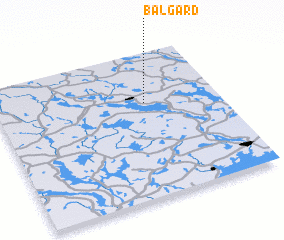 Places with similar names to Bålgård, Sweden ::
// Balakurda (ET)
// Blow Gourd (US)
// Bellaguarda (IT)
// Baligród (PL)
// Białogard (PL)
// Białogarda (PL)
// Białogrądy (PL)
// Belegrád (HU)
// Bulgurit (AL)
// Belgrat (TR)
Disclaimer :: Information on this page comes without warranty of any kind |
||
|
Where is Bålgård? Elevation and coordinates ::
Latitude (lat): 59°39'0"N Longitude (lon): 12°40'0"E
Elevation (approx.): 75m (map arrows pan, magnifying glasses zoom) |
||
|
Visiting Bålgård? Hotel/Accommodation ::
Book a hotel in Bålgård Travel Guide ::
Buy a travel guide for Sweden rental cars ::
car rental offers GPS waypoint ::
download a GPX waypoint (PoI) of Bålgård for your GPS receiver
|
||