|
search place name
|
||
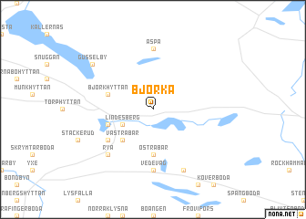
Björka (Örebro, Sweden)Björka is a town in the Örebro region of Sweden. An overview map of the region around Björka is displayed below.
regional and 3d topo map of Björka, Sweden ::
Björka airports ::
The nearest airport is ORB - Orebro, located 44.2 km south of Björka.
Other airports nearby include KSK - Karlskoga (52.9 km south west), VST - Vasteras (76.3 km east), BLE - Borlange (92.5 km north), NRK - Norrkoeping Kungsangen (125.8 km south east), Nearby towns ::
Lindesberg (2.6km south west) //
Västra Bår (4.2km south west) //
Östra Bår (5.6km south) //
Dalkarlshyttan (3.4km south west) //
Björkhyttan (3.4km north west) //
Skottbackarna (4.7km south west) //
Vedevåg (7.4km south) //
Aspa (7.4km north) //
Rya (6.2km south west) //
Fryggesboda (7.6km south) //
Gusselby (6.7km north west) //
[all distances 'as the bird flies' and approximate] 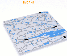 Places with similar names to Björka, Sweden ::
Disclaimer :: Information on this page comes without warranty of any kind |
||
|
Where is Björka? Elevation and coordinates ::
Latitude (lat): 59°36'0"N Longitude (lon): 15°17'0"E
Elevation (approx.): 94m (map arrows pan, magnifying glasses zoom) |
||
|
Visiting Björka? Hotel/Accommodation ::
Book a hotel in Björka Travel Guide ::
Buy a travel guide for Sweden rental cars ::
car rental offers GPS waypoint ::
download a GPX waypoint (PoI) of Björka for your GPS receiver
|
||