|
search place name
|
||
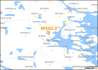
Bredglo (Kalmar, Sweden)Bredglo is a town in the Kalmar region of Sweden. An overview map of the region around Bredglo is displayed below.
regional and 3d topo map of Bredglo, Sweden ::
Bredglo airports ::
The nearest airport is OSK - Oskarshamn, located 28.1 km south of Bredglo.
Other airports nearby include HLF - Hultsfred (43.2 km west), LPI - Linkoeping Saab (102.6 km north west), KLR - Kalkmar Kalmar (103.2 km south), VBY - Visby (108.7 km east), Nearby towns ::
Örsebohagen (0.6km south) //
Blankaholm (2.3km south) //
Solstadström (2.3km south) //
Blanka (2.0km south west) //
Göljerum (2.2km north east) //
Repevassa (3.0km north west) //
Solstadgruva (3.6km south) //
Harnäs (4.4km south) //
Hålvik (4.2km south) //
Östra Slingsö (4.4km north west) //
Henriksnäs (3.0km east) //
Kallsebo (5.9km south) //
Skaftet (6.2km north east) //
Karlslund (5.7km north east) //
Fridhem (6.4km south east) //
Äskestock (4.4km east) //
Västrum (7.5km north) //
Falkemåla (6.3km north east) //
Rössle (7.7km north) //
Adriansnäs (7.2km south east) //
Vivastemåla (6.4km north east) //
Flivik (8.3km south) //
Yxnevik (7.5km north east) //
Gutan (9.7km north east) //
Berget (9.6km north east) //
[all distances 'as the bird flies' and approximate]  Places with similar names to Bredglo, Sweden ::
// Bardaklı (TR)
// Bardaklı (TR)
// Bardeh Gol (IR)
// Bard-e kal (IR)
// Bard Kaleh (IR)
// Burutagolla (LK)
// Bortigali (IT)
// Berdakel (RU)
Disclaimer :: Information on this page comes without warranty of any kind |
||
|
Where is Bredglo? Elevation and coordinates ::
Latitude (lat): 57°36'9"N Longitude (lon): 16°31'49"E
Elevation (approx.): 15m (map arrows pan, magnifying glasses zoom) |
||
|
Visiting Bredglo? Hotel/Accommodation ::
Book a hotel in Bredglo Travel Guide ::
Buy a travel guide for Sweden rental cars ::
car rental offers GPS waypoint ::
download a GPX waypoint (PoI) of Bredglo for your GPS receiver
|
||