|
search place name
|
||
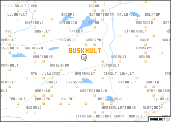
Buskhult (Kronoberg, Sweden)Buskhult is a town in the Kronoberg region of Sweden. An overview map of the region around Buskhult is displayed below.
regional and 3d topo map of Buskhult, Sweden ::
Buskhult airports ::
The nearest airport is HAD - Halmstad, located 46.5 km west of Buskhult.
Other airports nearby include VXO - Vaxjo Kronoberg (79.1 km north east), KID - Kristianstad (83.8 km south east), JLD - Landskrona (86.4 km south west), RNB - Ronneby (111.8 km east), Nearby towns ::
Tiböke (2.1km south east) //
Ekön (3.7km north) //
Hinneryd (2.0km east) //
Svenshult (3.7km south) //
Groeryd (3.8km north) //
Klausön (4.2km north west) //
Snällsböke (4.2km south east) //
Skrubberyd (4.2km south west) //
Råaköp (5.7km north) //
Gunghult (3.6km south east) //
Ingelsköp (3.6km south west) //
Grysshult (5.7km south) //
Öshult (4.8km south east) //
Knaplet (4.1km east) //
Forsa (7.5km north) //
Västra Tansjö (7.5km south) //
Mäseboda (7.7km north) //
Vivljunga (5.5km south west) //
Äsphult (6.9km north east) //
Vivhult (6.9km south west) //
Lönshult (8.5km south west) //
[all distances 'as the bird flies' and approximate] 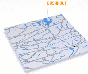
Disclaimer :: Information on this page comes without warranty of any kind |
||
|
Where is Buskhult? Elevation and coordinates ::
Latitude (lat): 56°37'0"N Longitude (lon): 13°34'0"E
Elevation (approx.): 173m (map arrows pan, magnifying glasses zoom) |
||
|
Visiting Buskhult? Hotel/Accommodation ::
Book a hotel in Buskhult Travel Guide ::
Buy a travel guide for Sweden rental cars ::
car rental offers GPS waypoint ::
download a GPX waypoint (PoI) of Buskhult for your GPS receiver
|
||