|
search place name
|
||
Drageryd (Jönköping, Sweden)Drageryd is a town in the Jönköping region of Sweden. An overview map of the region around Drageryd is displayed below.
regional and 3d topo map of Drageryd, Sweden ::

Drageryd airports ::
The nearest airport is JKG - Joenkoeping Jonkoping, located 46.1 km north west of Drageryd.
Other airports nearby include VXO - Vaxjo Kronoberg (60.2 km south), HLF - Hultsfred (72.7 km east), OSK - Oskarshamn (113.8 km east), KVB - Skovde (116.6 km north), Nearby towns ::
Hjälmseryd (1.0km east) //
Bringetofta (1.9km south) //
Mattarp (3.7km north) //
Havsjö (3.8km north) //
Forsa (2.7km south east) //
Broddarp (3.8km north) //
Femtinge (3.8km south) //
Gådeberg (4.2km north west) //
Strete (3.0km west) //
Rickelstorp (5.6km south) //
Ulvahult (5.9km north) //
Klev (5.9km north) //
Sjöaveka (5.9km north) //
Hjärtsöla (7.5km north) //
Hylte (4.4km north west) //
Lämmarp (4.4km south west) //
Komstad (7.5km south) //
Mejensjö (7.7km south) //
Mossaryd (8.0km south) //
Sävsjö (8.0km south) //
[all distances 'as the bird flies' and approximate] 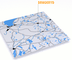 Places with similar names to Drageryd, Sweden ::
// Drageryd (SE)
Disclaimer :: Information on this page comes without warranty of any kind |
||
|
Where is Drageryd? Elevation and coordinates ::
Latitude (lat): 57°28'0"N Longitude (lon): 14°37'0"E
Elevation (approx.): 280m (map arrows pan, magnifying glasses zoom) |
||
|
Visiting Drageryd? Hotel/Accommodation ::
Book a hotel in Drageryd Travel Guide ::
Buy a travel guide for Sweden rental cars ::
car rental offers GPS waypoint ::
download a GPX waypoint (PoI) of Drageryd for your GPS receiver
|
||