|
search place name
|
||
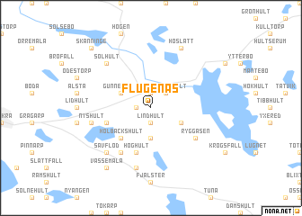
Flugenäs (Kalmar, Sweden)Flugenäs is a town in the Kalmar region of Sweden. An overview map of the region around Flugenäs is displayed below.
regional and 3d topo map of Flugenäs, Sweden ::
Flugenäs airports ::
The nearest airport is HLF - Hultsfred, located 21.6 km south west of Flugenäs.
Other airports nearby include OSK - Oskarshamn (46.4 km south east), LPI - Linkoeping Saab (83.2 km north), NRK - Norrkoeping Kungsangen (101.4 km north), KLR - Kalkmar Kalmar (112.2 km south), Nearby towns ::
Grönlid (1.0km west) //
Lindhult (1.9km south) //
Rössle (1.0km west) //
Godhult (1.9km north) //
Frödingehult (2.1km north east) //
Höghult (3.7km south) //
Gunnekulla (2.7km north west) //
Frödinge (2.7km north west) //
Brantestad (2.7km south east) //
Holbäckshult (4.2km south west) //
Nyserum (3.5km south west) //
Höghult (5.6km south) //
Ryggåsen (4.8km south east) //
Grinderum (5.9km south) //
Hällerum (7.5km south) //
Nyshult (4.4km south west) //
Solhult (6.3km north west) //
Sävflod (6.3km south west) //
Höslätt (7.7km north) //
Vassemåla (8.0km south) //
Skänninge (8.4km north west) //
[all distances 'as the bird flies' and approximate] 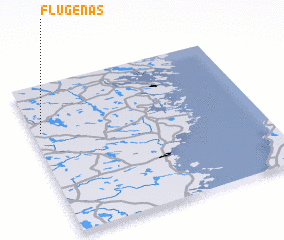 Places with similar names to Flugenäs, Sweden ::
Disclaimer :: Information on this page comes without warranty of any kind |
||
|
Where is Flugenäs? Elevation and coordinates ::
Latitude (lat): 57°41'0"N Longitude (lon): 16°2'0"E
Elevation (approx.): 117m (map arrows pan, magnifying glasses zoom) |
||
|
Visiting Flugenäs? Hotel/Accommodation ::
Book a hotel in Flugenäs Travel Guide ::
Buy a travel guide for Sweden rental cars ::
car rental offers GPS waypoint ::
download a GPX waypoint (PoI) of Flugenäs for your GPS receiver
|
||