|
search place name
|
||
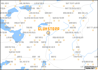
Glumstorp (Värmland, Sweden)Glumstorp is a town in the Värmland region of Sweden. An overview map of the region around Glumstorp is displayed below.
regional and 3d topo map of Glumstorp, Sweden ::
Glumstorp airports ::
The nearest airport is KSK - Karlskoga, located 40.5 km south east of Glumstorp.
Other airports nearby include ORB - Orebro (74.2 km south east), KVB - Skovde (116.5 km south), LDK - Lidkoping (121.6 km south), BLE - Borlange (138.6 km north east), Nearby towns ::
Mosserud (0.9km west) //
Mo (2.1km north west) //
Viberg (3.7km north) //
Såtång (2.6km south west) //
Rödmossen (2.6km south east) //
Glumserud (3.8km south) //
Söre (3.8km south) //
Backa (4.2km south east) //
Rösebäcken (5.6km south) //
Asplunden (5.6km north) //
Svenserud (5.6km north) //
Heden (3.4km south west) //
Skogsberg (3.4km north west) //
Älgånäs (3.4km north east) //
Lövhöjden (3.4km south east) //
Sundstorp (5.9km north) //
Motorp (4.7km south west) //
Västanå (4.7km south west) //
Snaversrud (3.8km west) //
Såneby (7.4km north) //
Tågås (4.2km north west) //
Göranstorp (4.2km north east) //
Slängserud (6.2km north west) //
Slängserudstorp (6.2km north west) //
Hult (6.7km south west) //
Laskerud (7.9km north) //
Ängebäckstorp (6.7km north east) //
Ängebäck (8.3km north east) //
Fasterud (8.3km north west) //
[all distances 'as the bird flies' and approximate] 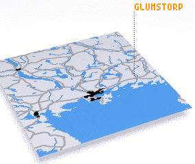 Places with similar names to Glumstorp, Sweden ::
// Glömstorp (SE)
// Klämmestorp (SE)
Disclaimer :: Information on this page comes without warranty of any kind |
||
|
Where is Glumstorp? Elevation and coordinates ::
Latitude (lat): 59°30'0"N Longitude (lon): 13°51'0"E
Elevation (approx.): 82m (map arrows pan, magnifying glasses zoom) |
||
|
Visiting Glumstorp? Hotel/Accommodation ::
Book a hotel in Glumstorp Travel Guide ::
Buy a travel guide for Sweden rental cars ::
car rental offers GPS waypoint ::
download a GPX waypoint (PoI) of Glumstorp for your GPS receiver
|
||