|
search place name
|
||
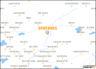
Grönahög ((( Älvsborg )), Sweden)Grönahög is a town in the (( Älvsborg )) region of Sweden. An overview map of the region around Grönahög is displayed below.
regional and 3d topo map of Grönahög, Sweden ::
Grönahög airports ::
The nearest airport is JKG - Joenkoeping Jonkoping, located 30.7 km east of Grönahög.
Other airports nearby include GOT - Gothenborg Landvetter (77.8 km west), KVB - Skovde (90.9 km north), LDK - Lidkoping (92.2 km north), GSE - Gothenborg Save (102.8 km west), Nearby towns ::
Solberga (2.1km north east) //
Odla (4.2km north west) //
Skogen (4.2km north west) //
Lindrum (4.2km south east) //
Ölsremma (5.6km south) //
Grebbaslätt (5.6km south) //
Lid (4.8km south east) //
Övre Björstorp (7.4km south) //
Gästared (7.5km north) //
Växtorp (6.3km south west) //
Algrena (5.4km south east) //
Påbo (6.8km north west) //
Hjärtared (8.0km south) //
Skogarp (8.4km south west) //
[all distances 'as the bird flies' and approximate] 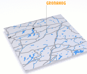 Places with similar names to Grönahög, Sweden ::
Disclaimer :: Information on this page comes without warranty of any kind |
||
|
Where is Grönahög? Elevation and coordinates ::
Latitude (lat): 57°40'0"N Longitude (lon): 13°35'0"E
Elevation (approx.): 250m (map arrows pan, magnifying glasses zoom) |
||
|
Visiting Grönahög? Hotel/Accommodation ::
Book a hotel in Grönahög Travel Guide ::
Buy a travel guide for Sweden rental cars ::
car rental offers GPS waypoint ::
download a GPX waypoint (PoI) of Grönahög for your GPS receiver
|
||