|
search place name
|
||
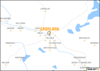
Grönland (Dalarna, Sweden)Grönland is a town in the Dalarna region of Sweden. An overview map of the region around Grönland is displayed below.
regional and 3d topo map of Grönland, Sweden ::
Grönland airports ::
The nearest airport is MXX - Mora, located 53.0 km north east of Grönland.
Other airports nearby include BLE - Borlange (102.9 km east), KSK - Karlskoga (155.2 km south), EVG - Sveg (156.7 km north), ORB - Orebro (178.6 km south east), Nearby towns ::
Åsbyn (0.0km north) //
Backa (0.0km north) //
Orrmyrheden (0.9km east) //
Holarna (0.9km east) //
Tällbyn (1.9km south) //
Grimsmyrheden (0.9km west) //
Storbyn (0.9km west) //
Albacken (1.9km north) //
Grimsåker (2.1km south east) //
Myckelbyn (2.1km south west) //
Malung (2.1km south west) //
Böle (3.7km south) //
Hole (1.8km west) //
Östra Utsjö (3.8km south) //
Norra Mon (2.6km north west) //
Södra Mon (2.6km north west) //
Västra Utsjö (5.6km south) //
Idbäck (3.3km north west) //
[all distances 'as the bird flies' and approximate] 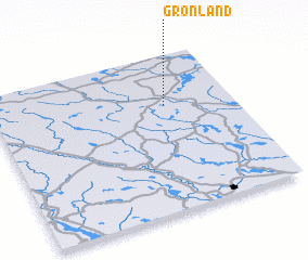 Places with similar names to Grönland, Sweden ::
Disclaimer :: Information on this page comes without warranty of any kind |
||
|
Where is Grönland? Elevation and coordinates ::
Latitude (lat): 60°41'0"N Longitude (lon): 13°43'0"E
(map arrows pan, magnifying glasses zoom) |
||
|
Visiting Grönland? Hotel/Accommodation ::
Book a hotel in Grönland Travel Guide ::
Buy a travel guide for Sweden rental cars ::
car rental offers GPS waypoint ::
download a GPX waypoint (PoI) of Grönland for your GPS receiver
|
||