|
search place name
|
||
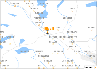
Hagen (Västmanland, Sweden)Hagen is a town in the Västmanland region of Sweden. An overview map of the region around Hagen is displayed below.
regional and 3d topo map of Hagen, Sweden ::
Hagen airports ::
The nearest airport is VST - Vasteras, located 44.3 km east of Hagen.
Other airports nearby include ORB - Orebro (62.3 km south west), KSK - Karlskoga (81.8 km west), BLE - Borlange (93.5 km north), NYO - Stockholm Skavsta (108.9 km south east), Nearby towns ::
Kanada (0.0km north) //
Kolsva (0.9km west) //
Guttsta (2.1km south east) //
Tullen (2.1km north west) //
Lundby (2.6km north east) //
Vallsta (3.8km south) //
Åkerby (3.8km south) //
Gisslarbo (4.2km north west) //
Kulinge (3.4km south east) //
Nibbarsbo (5.9km north) //
Hörnberga (7.5km south) //
Svansbo (7.6km north) //
Körtinge (7.6km south) //
Julberga (7.6km south) //
Bollströ (7.6km south) //
Lersäter (6.7km north east) //
Frosta (7.9km south) //
Fröberga (7.9km south) //
Åsby (6.7km south east) //
[all distances 'as the bird flies' and approximate] 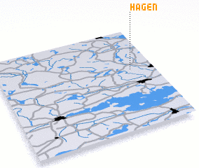 Places with similar names to Hagen, Sweden ::
Disclaimer :: Information on this page comes without warranty of any kind |
||
|
Where is Hagen? Elevation and coordinates ::
Latitude (lat): 59°36'0"N Longitude (lon): 15°51'0"E
Elevation (approx.): 78m (map arrows pan, magnifying glasses zoom) |
||
|
Visiting Hagen? Hotel/Accommodation ::
Book a hotel in Hagen Travel Guide ::
Buy a travel guide for Sweden rental cars ::
car rental offers GPS waypoint ::
download a GPX waypoint (PoI) of Hagen for your GPS receiver
|
||