|
search place name
|
||
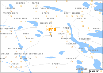
Heda (Kalmar, Sweden)Heda is a town in the Kalmar region of Sweden. An overview map of the region around Heda is displayed below.
regional and 3d topo map of Heda, Sweden ::
Heda airports ::
The nearest airport is HLF - Hultsfred, located 51.3 km south west of Heda.
Other airports nearby include OSK - Oskarshamn (59.9 km south), LPI - Linkoeping Saab (70.9 km north west), NRK - Norrkoeping Kungsangen (78.6 km north), NYO - Stockholm Skavsta (105.8 km north), Nearby towns ::
Ullevi (2.0km east) //
Rödja (3.7km north) //
Gamleby (2.7km north east) //
Stångeland (3.8km north) //
Fästad (5.6km north) //
Enestorp (3.5km south east) //
Solna (3.7km north east) //
Stäket (3.7km north east) //
Ekebo (3.7km north east) //
Berget (3.7km east) //
Borghult (4.4km south west) //
Droppstad (7.5km north) //
Olserum (7.5km north) //
Himmelsrum (7.5km north) //
Rumma (6.3km north west) //
Segelrum (5.4km south east) //
Älmarsrum (8.0km south) //
Hult (8.0km south) //
Skaftekulla (8.0km south) //
Vida (8.0km north) //
Björnsholm (8.4km north east) //
[all distances 'as the bird flies' and approximate] 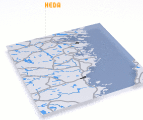 Places with similar names to Heda, Sweden ::
Disclaimer :: Information on this page comes without warranty of any kind |
||
|
Where is Heda? Elevation and coordinates ::
Latitude (lat): 57°53'0"N Longitude (lon): 16°22'0"E
Elevation (approx.): 77m (map arrows pan, magnifying glasses zoom) |
||
|
Visiting Heda? Hotel/Accommodation ::
Book a hotel in Heda Travel Guide ::
Buy a travel guide for Sweden rental cars ::
car rental offers GPS waypoint ::
download a GPX waypoint (PoI) of Heda for your GPS receiver
|
||