|
search place name
|
||
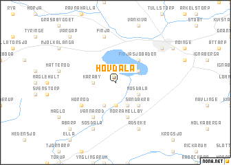
Hovdala ((( Kristianstad )), Sweden)Hovdala is a town in the (( Kristianstad )) region of Sweden. An overview map of the region around Hovdala is displayed below.
regional and 3d topo map of Hovdala, Sweden ::
Hovdala airports ::
The nearest airport is KID - Kristianstad, located 31.2 km south east of Hovdala.
Other airports nearby include JLD - Landskrona (54.6 km west), MMX - Malmoe Sturup (66.7 km south), CPH - Copenhagen Kastrup (84.6 km south west), HAD - Halmstad (85.3 km north west), Nearby towns ::
Karaby (2.1km west) //
Björkeberga (3.7km south) //
Tormestorp (2.8km north east) //
Nösdala (2.8km south east) //
Lunnahöja (3.8km south) //
Brönnestad (3.8km south) //
Finjasjöbaden (4.2km north east) //
Sandåkra (4.2km south east) //
Norra Mellby (5.7km south) //
Hörröd (4.8km south west) //
Vannaröd (5.9km south) //
Finja (7.5km north) //
Sösdala (7.7km south) //
Adseke (7.7km south) //
Hässleholm (6.9km north east) //
Åbarp (8.5km south west) //
Värgap (8.5km north west) //
[all distances 'as the bird flies' and approximate] 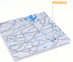
Disclaimer :: Information on this page comes without warranty of any kind |
||
|
Where is Hovdala? Elevation and coordinates ::
Latitude (lat): 56°6'0"N Longitude (lon): 13°42'0"E
Elevation (approx.): 105m (map arrows pan, magnifying glasses zoom) |
||
|
Visiting Hovdala? Hotel/Accommodation ::
Book a hotel in Hovdala Travel Guide ::
Buy a travel guide for Sweden rental cars ::
car rental offers GPS waypoint ::
download a GPX waypoint (PoI) of Hovdala for your GPS receiver
|
||