|
search place name
|
||
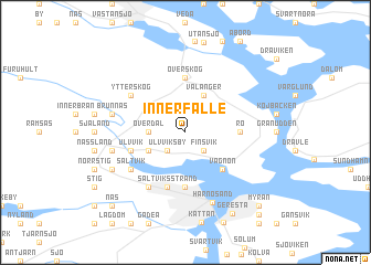
Innerfälle (Västernorrland, Sweden)Innerfälle is a town in the Västernorrland region of Sweden. An overview map of the region around Innerfälle is displayed below.
regional and 3d topo map of Innerfälle, Sweden ::
Innerfälle airports ::
The nearest airport is SDL - Sundsvall Harnosand, located 30.9 km south west of Innerfälle.
Other airports nearby include KRF - Kramfors Solleftea (39.6 km north), OER - Ornskoldsvik (95.8 km north east), HUV - Hudiksvall (112.6 km south west), LYC - Lycksele (209.8 km north), Nearby towns ::
Finsvik (2.0km south east) //
Ulvviks By (2.0km south west) //
Överdal (1.7km west) //
Vålånger (3.8km north) //
Svedje (2.5km south west) //
Vägnön (4.1km south east) //
Överskog (5.6km north) //
Rö (2.6km east) //
Murberget (5.6km south) //
Ulvvik (3.2km south west) //
Saltviksstrand (5.6km south) //
Ytterskog (4.5km north west) //
Saltvik (4.5km south west) //
Bondsjö (5.8km south) //
Härnösand (7.2km south) //
Berge (3.9km north west) //
Brunnäs (3.9km north west) //
Kragom (3.9km south west) //
Lövvik (5.0km south west) //
Geresta (8.5km south) //
Myran (8.2km south east) //
Näs (8.2km south west) //
Kapellsberg (9.0km south) //
[all distances 'as the bird flies' and approximate] 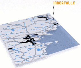 Places with similar names to Innerfälle, Sweden ::
// Inoorvillu (LK)
// Inriville (AR)
Disclaimer :: Information on this page comes without warranty of any kind |
||
|
Where is Innerfälle? Elevation and coordinates ::
Latitude (lat): 62°42'0"N Longitude (lon): 17°55'0"E
(map arrows pan, magnifying glasses zoom) |
||
|
Visiting Innerfälle? Hotel/Accommodation ::
Book a hotel in Innerfälle Travel Guide ::
Buy a travel guide for Sweden rental cars ::
car rental offers GPS waypoint ::
download a GPX waypoint (PoI) of Innerfälle for your GPS receiver
|
||