|
search place name
|
||
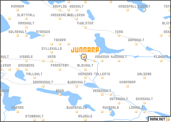
Junnarp (Kalmar, Sweden)Junnarp is a town in the Kalmar region of Sweden. An overview map of the region around Junnarp is displayed below.
regional and 3d topo map of Junnarp, Sweden ::
Junnarp airports ::
The nearest airport is HLF - Hultsfred, located 12.6 km west of Junnarp.
Other airports nearby include OSK - Oskarshamn (34.5 km south east), KLR - Kalkmar Kalmar (95.7 km south), LPI - Linkoeping Saab (99.4 km north), VXO - Vaxjo Kronoberg (103.6 km south west), Nearby towns ::
Alsarp (0.0km north) //
Blaxhult (1.9km south) //
Danevik (1.0km east) //
Versnäs (3.7km south) //
Väderum (2.0km east) //
Flatebo (4.2km north west) //
Tälleryd (4.2km south east) //
Främsteby (3.5km south west) //
Bjärkhult (5.6km south) //
Tokarp (4.8km north west) //
Skinnarp (4.8km north west) //
Vena (4.0km west) //
Fjälster (7.4km north) //
Mjöshult (4.0km east) //
Gyllekulla (4.4km north west) //
Björksebo (5.4km north west) //
Vederhult (7.7km south) //
Boda (8.0km south) //
Tråda (8.0km south) //
Tuna (6.8km north east) //
[all distances 'as the bird flies' and approximate] 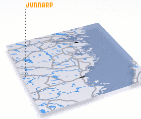 Places with similar names to Junnarp, Sweden ::
Disclaimer :: Information on this page comes without warranty of any kind |
||
|
Where is Junnarp? Elevation and coordinates ::
Latitude (lat): 57°32'0"N Longitude (lon): 16°2'0"E
Elevation (approx.): 113m (map arrows pan, magnifying glasses zoom) |
||
|
Visiting Junnarp? Hotel/Accommodation ::
Book a hotel in Junnarp Travel Guide ::
Buy a travel guide for Sweden rental cars ::
car rental offers GPS waypoint ::
download a GPX waypoint (PoI) of Junnarp for your GPS receiver
|
||