|
search place name
|
||
Kammarebo (Halland, Sweden)Kammarebo is a town in the Halland region of Sweden. An overview map of the region around Kammarebo is displayed below.
regional and 3d topo map of Kammarebo, Sweden ::

Kammarebo airports ::
The nearest airport is HAD - Halmstad, located 33.7 km south of Kammarebo.
Other airports nearby include GOT - Gothenborg Landvetter (86.2 km north west), VXO - Vaxjo Kronoberg (107.3 km east), JKG - Joenkoeping Jonkoping (108.8 km north east), GSE - Gothenborg Save (110.1 km north west), Nearby towns ::
Älmö (1.9km north) //
Övre Mossared (2.1km north west) //
Häshult (2.0km east) //
Drängsered (3.7km north) //
Yttre Störshult (3.8km north) //
Galtabo (3.8km north) //
Axet (2.7km north west) //
Yttre Mossared (2.7km north west) //
Sjöbol (3.8km north) //
Häradsbo (5.6km south) //
Lilla Glöshult (3.6km south west) //
Stora Glöshult (3.6km south west) //
Härhult (4.4km south east) //
Yttra Långhult (7.5km north) //
Björsjö (5.5km north east) //
Övra Långhult (7.7km north) //
Ramsered (5.5km north west) //
[all distances 'as the bird flies' and approximate] 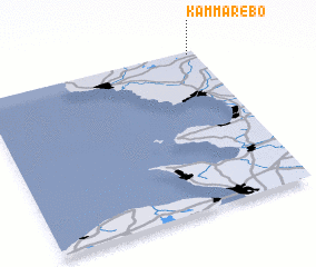 Places with similar names to Kammarebo, Sweden ::
Disclaimer :: Information on this page comes without warranty of any kind |
||
|
Where is Kammarebo? Elevation and coordinates ::
Latitude (lat): 56°59'0"N Longitude (lon): 12°58'0"E
Elevation (approx.): 148m (map arrows pan, magnifying glasses zoom) |
||
|
Visiting Kammarebo? Hotel/Accommodation ::
Book a hotel in Kammarebo Travel Guide ::
Buy a travel guide for Sweden rental cars ::
car rental offers GPS waypoint ::
download a GPX waypoint (PoI) of Kammarebo for your GPS receiver
|
||