|
search place name
|
||
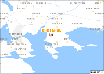
Karterud (Värmland, Sweden)Karterud is a town in the Värmland region of Sweden. An overview map of the region around Karterud is displayed below.
regional and 3d topo map of Karterud, Sweden ::
Karterud airports ::
The nearest airport is KSK - Karlskoga, located 72.8 km east of Karterud.
Other airports nearby include LDK - Lidkoping (96.7 km south), ORB - Orebro (104.5 km east), KVB - Skovde (107.0 km south east), THN - Trollhattan Vanersborg (123.8 km south west), Nearby towns ::
Solberg (2.1km south east) //
Åsundatorp (3.7km south) //
Åsunda (3.8km south) //
Frubacka (3.8km north) //
Segerstad (5.6km north) //
Bråte (3.4km south east) //
Norsbron (7.5km north) //
Norra Törne (7.5km north) //
Södra Törne (7.5km north) //
Lilla Bårum (7.5km north) //
Stora Bårum (7.7km north) //
Medskog (6.7km north west) //
Vålberg (7.9km north) //
[all distances 'as the bird flies' and approximate]  Places with similar names to Karterud, Sweden ::
// Carteret (US)
// Guaratarito (CO)
// Guaratarito (CO)
// Guaratirito (CO)
// Carretera 03 (VE)
// Corderito (VE)
// Guaratarito (VE)
// Guaratarito (VE)
// Cœur Droit (HT)
// Korterud (SE)
Disclaimer :: Information on this page comes without warranty of any kind |
||
|
Where is Karterud? Elevation and coordinates ::
Latitude (lat): 59°20'0"N Longitude (lon): 13°13'0"E
Elevation (approx.): 78m (map arrows pan, magnifying glasses zoom) |
||
|
Visiting Karterud? Hotel/Accommodation ::
Book a hotel in Karterud Travel Guide ::
Buy a travel guide for Sweden rental cars ::
car rental offers GPS waypoint ::
download a GPX waypoint (PoI) of Karterud for your GPS receiver
|
||