|
search place name
|
||
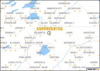
Kopparebygd (Kronoberg, Sweden)Kopparebygd is a town in the Kronoberg region of Sweden. An overview map of the region around Kopparebygd is displayed below.
regional and 3d topo map of Kopparebygd, Sweden ::
Kopparebygd airports ::
The nearest airport is VXO - Vaxjo Kronoberg, located 65.4 km north east of Kopparebygd.
Other airports nearby include KID - Kristianstad (66.7 km south), HAD - Halmstad (73.0 km west), RNB - Ronneby (84.9 km east), JLD - Landskrona (93.2 km south west), Nearby towns ::
Sköldsbygd (1.9km north) //
Torsholma (2.1km south east) //
Holmseryd (2.0km west) //
Kölaboda (3.8km north) //
Delary (3.8km north) //
Örsnäs (4.2km south west) //
Näs (5.6km north) //
Kalvshult (5.6km south) //
Elisköp (3.6km north west) //
Skateboda (5.9km north) //
Årbohult (5.9km south) //
Väraberga (7.4km north) //
Lindås (4.1km east) //
Drakeberga (7.4km south) //
Slagersköp (4.1km west) //
Gårdstaköp (4.1km west) //
Linnefalla (4.5km south west) //
Kroksbygd (4.5km south west) //
Ramnäs (6.3km north west) //
Brokhult (5.5km north east) //
Kruseböke (5.5km south east) //
Hultet (5.5km north west) //
Kylen (7.7km south) //
Kråkeryd (5.5km south west) //
Skärshult (8.0km north) //
[all distances 'as the bird flies' and approximate] 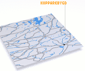 Places with similar names to Kopparebygd, Sweden :: Disclaimer :: Information on this page comes without warranty of any kind |
||
|
Where is Kopparebygd? Elevation and coordinates ::
Latitude (lat): 56°31'0"N Longitude (lon): 13°58'0"E
Elevation (approx.): 136m (map arrows pan, magnifying glasses zoom) |
||
|
Visiting Kopparebygd? Hotel/Accommodation ::
Book a hotel in Kopparebygd Travel Guide ::
Buy a travel guide for Sweden rental cars ::
car rental offers GPS waypoint ::
download a GPX waypoint (PoI) of Kopparebygd for your GPS receiver
|
||