|
search place name
|
||
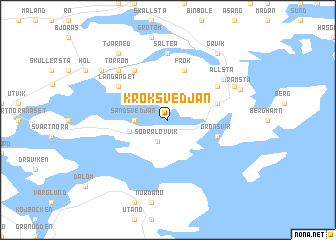
Kroksvedjan (Västernorrland, Sweden)Kroksvedjan is a town in the Västernorrland region of Sweden. An overview map of the region around Kroksvedjan is displayed below.
regional and 3d topo map of Kroksvedjan, Sweden ::
Kroksvedjan airports ::
The nearest airport is KRF - Kramfors Solleftea, located 31.8 km north west of Kroksvedjan.
Other airports nearby include SDL - Sundsvall Harnosand (47.8 km south west), OER - Ornskoldsvik (78.9 km north east), HUV - Hudiksvall (129.0 km south west), LYC - Lycksele (195.2 km north), Nearby towns ::
Bölesta (2.0km north west) //
Södra Lövvik (2.5km south) //
Sandsvedjan (1.7km west) //
Norra Lövvik (2.3km south west) //
Hålsång (3.1km north east) //
Grönsvik (3.1km south east) //
Frök (5.6km north) //
Östanö (4.5km north east) //
Långänget (4.5km north west) //
Berge (5.8km north) //
Salteå (7.4km north) //
Kallsta (7.4km north) //
Allsta (5.3km north east) //
Bredsäter (6.1km north west) //
Torrom (6.1km north west) //
Övergård (5.0km north east) //
Ramsta (5.0km north east) //
Salom (7.8km north) //
Gavik (7.8km north) //
Tjärned (7.8km north) //
Gräta (6.5km north west) //
Rossvik (6.5km north west) //
[all distances 'as the bird flies' and approximate] 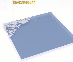 Places with similar names to Kroksvedjan, Sweden :: Disclaimer :: Information on this page comes without warranty of any kind |
||
|
Where is Kroksvedjan? Elevation and coordinates ::
Latitude (lat): 62°49'0"N Longitude (lon): 18°8'0"E
(map arrows pan, magnifying glasses zoom) |
||
|
Visiting Kroksvedjan? Hotel/Accommodation ::
Book a hotel in Kroksvedjan Travel Guide ::
Buy a travel guide for Sweden rental cars ::
car rental offers GPS waypoint ::
download a GPX waypoint (PoI) of Kroksvedjan for your GPS receiver
|
||