|
search place name
|
||
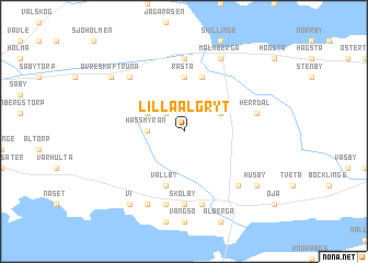
Lilla Algryt (Västmanland, Sweden)Lilla Algryt is a town in the Västmanland region of Sweden. An overview map of the region around Lilla Algryt is displayed below.
regional and 3d topo map of Lilla Algryt, Sweden ::
Lilla Algryt airports ::
The nearest airport is VST - Vasteras, located 41.0 km north east of Lilla Algryt.
Other airports nearby include ORB - Orebro (61.2 km west), NYO - Stockholm Skavsta (78.6 km south east), NRK - Norrkoeping Kungsangen (85.6 km south), KSK - Karlskoga (90.3 km west), Nearby towns ::
Danbo (2.1km north west) //
Hassmyran (1.9km west) //
Aspesten (2.6km north west) //
Lenmora (2.6km north east) //
Råsta (5.6km north) //
Råby (5.6km south) //
Vallby (5.6km south) //
Dammen (5.6km north) //
Kungsör (7.4km north) //
Skölby (7.4km south) //
Herrdal (4.2km north east) //
Berga (7.5km south) //
Malmberga (7.5km south) //
Granhammar (6.2km north west) //
Frasta (6.2km south east) //
Konungsö (7.7km south) //
Malmberga (7.6km north) //
Övre Skäftruna (6.7km north west) //
Vi (7.9km south) //
Husby (6.7km south east) //
[all distances 'as the bird flies' and approximate] 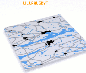 Places with similar names to Lilla Algryt, Sweden ::
// Lilla Lekeryd (SE)
Disclaimer :: Information on this page comes without warranty of any kind |
||
|
Where is Lilla Algryt? Elevation and coordinates ::
Latitude (lat): 59°21'0"N Longitude (lon): 16°5'0"E
Elevation (approx.): 60m (map arrows pan, magnifying glasses zoom) |
||
|
Visiting Lilla Algryt? Hotel/Accommodation ::
Book a hotel in Lilla Algryt Travel Guide ::
Buy a travel guide for Sweden rental cars ::
car rental offers GPS waypoint ::
download a GPX waypoint (PoI) of Lilla Algryt for your GPS receiver
|
||