|
search place name
|
||
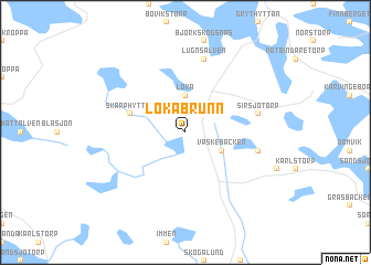
Lokabrunn (Örebro, Sweden)Lokabrunn is a town in the Örebro region of Sweden. An overview map of the region around Lokabrunn is displayed below.
regional and 3d topo map of Lokabrunn, Sweden ::
Lokabrunn airports ::
The nearest airport is KSK - Karlskoga, located 28.4 km south of Lokabrunn.
Other airports nearby include ORB - Orebro (53.0 km south east), BLE - Borlange (108.7 km north east), KVB - Skovde (130.5 km south), LDK - Lidkoping (146.5 km south west), Nearby towns ::
Finnhyttan (3.7km north) //
Loka (3.7km north) //
Vaskebäcken (2.6km south east) //
Skarphyttan (3.4km north west) //
Sirsjötorp (4.2km north east) //
Limmingen (4.2km south east) //
Lugnsälven (7.5km north) //
[all distances 'as the bird flies' and approximate] 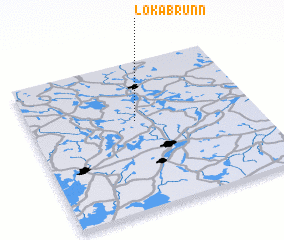 Places with similar names to Lokabrunn, Sweden ::
// Lake Bruin (US)
// Lockbourne (US)
// Lakeburn (CA)
// Lake Brown (AU)
// Legbourne (GB)
// Lagoubran (FR)
// Le Gabaron (FR)
Disclaimer :: Information on this page comes without warranty of any kind |
||
|
Where is Lokabrunn? Elevation and coordinates ::
Latitude (lat): 59°36'0"N Longitude (lon): 14°28'0"E
Elevation (approx.): 238m (map arrows pan, magnifying glasses zoom) |
||
|
Visiting Lokabrunn? Hotel/Accommodation ::
Book a hotel in Lokabrunn Travel Guide ::
Buy a travel guide for Sweden rental cars ::
car rental offers GPS waypoint ::
download a GPX waypoint (PoI) of Lokabrunn for your GPS receiver
|
||