|
search place name
|
||
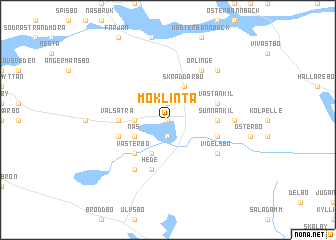
Möklinta (Västmanland, Sweden)Möklinta is a town in the Västmanland region of Sweden. An overview map of the region around Möklinta is displayed below.
regional and 3d topo map of Möklinta, Sweden ::
Möklinta airports ::
The nearest airport is VST - Vasteras, located 55.3 km south of Möklinta.
Other airports nearby include GVX - Gavle (61.3 km north), BLE - Borlange (67.8 km north west), ARN - Stockholm Arlanda (91.3 km south east), BMA - Stockholm Bromma (113.5 km south east), Nearby towns ::
Visbäck (0.0km north) //
Forneby (1.9km south) //
Kanikbo (1.9km north) //
Läckenbo (1.8km west) //
Näs (2.6km south west) //
Norrvad (3.8km south) //
Östervad (3.8km south) //
Skräddarbo (3.8km north) //
Västerbo (4.1km south west) //
Valsätra (2.8km west) //
Nordankil (2.8km east) //
Sunnankil (2.8km east) //
Hede (5.6km south) //
Klinta (3.3km south west) //
Hillersbo (3.3km south east) //
Västankil (3.3km north east) //
Hebo (5.9km south) //
Vigelsbo (4.6km south east) //
Gammelby (5.9km north) //
Örlinge (5.9km north) //
Östankil (3.7km east) //
Goddarbo (6.2km north east) //
[all distances 'as the bird flies' and approximate]  Places with similar names to Möklinta, Sweden ::
Disclaimer :: Information on this page comes without warranty of any kind |
||
|
Where is Möklinta? Elevation and coordinates ::
Latitude (lat): 60°5'0"N Longitude (lon): 16°32'0"E
(map arrows pan, magnifying glasses zoom) |
||
|
Visiting Möklinta? Hotel/Accommodation ::
Book a hotel in Möklinta Travel Guide ::
Buy a travel guide for Sweden rental cars ::
car rental offers GPS waypoint ::
download a GPX waypoint (PoI) of Möklinta for your GPS receiver
|
||