|
search place name
|
||
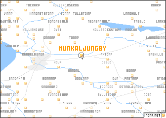
Munka-Ljungby ((( Kristianstad )), Sweden)Munka-Ljungby is a town in the (( Kristianstad )) region of Sweden. An overview map of the region around Munka-Ljungby is displayed below.
regional and 3d topo map of Munka-Ljungby, Sweden ::
Munka-Ljungby airports ::
The nearest airport is JLD - Landskrona, located 34.6 km south of Munka-Ljungby.
Other airports nearby include HAD - Halmstad (49.9 km north), CPH - Copenhagen Kastrup (73.0 km south), KID - Kristianstad (78.7 km south east), MMX - Malmoe Sturup (84.1 km south), Nearby towns ::
Hillarp (1.9km north) //
Toarp (3.8km north) //
Tåstarp (3.8km north) //
Mardal (3.8km south) //
Ugglarp (5.6km south) //
Axtorp (3.1km east) //
Starby (5.7km south) //
Höja (3.6km south west) //
Össjö (3.6km south east) //
Ryet (6.4km north west) //
Källna (6.4km south east) //
Kollebäckstorp (6.4km north east) //
Äspenäs (7.7km north) //
Nedre Århult (7.7km north) //
Gånarp (5.5km north west) //
Öja (6.9km south east) //
Bonnarp (6.9km south west) //
Härninge (8.0km south west) //
Söndrebalg (8.0km north west) //
Hjärnarp (8.0km north west) //
Tranarp (8.0km south east) //
Bolestad (8.5km south east) //
Spannarp (8.5km south west) //
[all distances 'as the bird flies' and approximate] 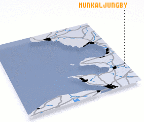 Places with similar names to Munka-Ljungby, Sweden :: Disclaimer :: Information on this page comes without warranty of any kind |
||
|
Where is Munka-Ljungby? Elevation and coordinates ::
Latitude (lat): 56°15'0"N Longitude (lon): 12°58'0"E
Elevation (approx.): 23m (map arrows pan, magnifying glasses zoom) |
||
|
Visiting Munka-Ljungby? Hotel/Accommodation ::
Book a hotel in Munka-Ljungby Travel Guide ::
Buy a travel guide for Sweden rental cars ::
car rental offers GPS waypoint ::
download a GPX waypoint (PoI) of Munka-Ljungby for your GPS receiver
|
||