|
search place name
|
||
Neder Söderby (Stockholm, Sweden)Neder Söderby is a town in the Stockholm region of Sweden. An overview map of the region around Neder Söderby is displayed below.
regional and 3d topo map of Neder Söderby, Sweden ::

Neder Söderby airports ::
The nearest airport is BMA - Stockholm Bromma, located 35.9 km north of Neder Söderby.
Other airports nearby include NYO - Stockholm Skavsta (62.2 km south west), ARN - Stockholm Arlanda (68.9 km north), VST - Vasteras (94.4 km north west), NRK - Norrkoeping Kungsangen (106.7 km south west), Nearby towns ::
Trollsta (1.9km north) //
Grödby (1.9km north) //
Norr-Rangsta (2.1km north west) //
Väggarö (4.2km south west) //
Överfors (4.2km south east) //
Vinaren (5.6km north) //
Västerby (5.6km north) //
Ösmo (5.6km south) //
Österby (5.8km north) //
Över Söderby (5.8km north) //
Lyngsta (5.9km south) //
Lundby (5.9km north) //
Sittesta (5.9km south) //
Torp (4.2km south west) //
Gryt (7.5km south) //
Blista (6.3km south west) //
Södra Enby (5.3km south west) //
Kängsta (5.3km south east) //
Jursta (5.3km south east) //
Skogstorp (6.7km north west) //
Norra Stutby (6.7km north west) //
Berga (6.7km south west) //
Vidbynäs (9.3km south east) //
[all distances 'as the bird flies' and approximate] 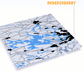 Places with similar names to Neder Söderby, Sweden :: Disclaimer :: Information on this page comes without warranty of any kind |
||
|
Where is Neder Söderby? Elevation and coordinates ::
Latitude (lat): 59°2'0"N Longitude (lon): 17°53'0"E
Elevation (approx.): 51m (map arrows pan, magnifying glasses zoom) |
||
|
Visiting Neder Söderby? Hotel/Accommodation ::
Book a hotel in Neder Söderby Travel Guide ::
Buy a travel guide for Sweden rental cars ::
car rental offers GPS waypoint ::
download a GPX waypoint (PoI) of Neder Söderby for your GPS receiver
|
||