|
search place name
|
||
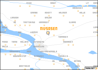
Nivsåsen (Jämtland, Sweden)Nivsåsen is a town in the Jämtland region of Sweden. An overview map of the region around Nivsåsen is displayed below.
regional and 3d topo map of Nivsåsen, Sweden ::
Nivsåsen airports ::
The nearest airport is OSD - Ostersund Froson, located 9.5 km west of Nivsåsen.
Other airports nearby include EVG - Sveg (131.0 km south), Nearby towns ::
Kånkbacken (0.8km east) //
Kännåsen (3.8km north) //
Östersund (4.1km south west) //
Lugnvik (2.5km west) //
Önsjön (5.6km north) //
Torråsen (3.1km south east) //
Odenslund (5.8km south) //
Åskott (7.4km north) //
Västra Odensala (7.4km south) //
Trättgärde (5.0km north west) //
Hornsberg (5.0km south west) //
Rannåsen (5.0km south east) //
Östra Odensala (7.6km south) //
Granbo (7.8km north) //
Halåsen (7.8km north) //
Namn (8.1km south west) //
Knytta (8.1km south west) //
[all distances 'as the bird flies' and approximate] 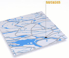 Places with similar names to Nivsåsen, Sweden ::
// Novyye Sosny (RU)
// Na Vysočině (CZ)
Disclaimer :: Information on this page comes without warranty of any kind |
||
|
Where is Nivsåsen? Elevation and coordinates ::
Latitude (lat): 63°13'0"N Longitude (lon): 14°41'0"E
(map arrows pan, magnifying glasses zoom) |
||
|
Visiting Nivsåsen? Hotel/Accommodation ::
Book a hotel in Nivsåsen Travel Guide ::
Buy a travel guide for Sweden rental cars ::
car rental offers GPS waypoint ::
download a GPX waypoint (PoI) of Nivsåsen for your GPS receiver
|
||