|
search place name
|
||
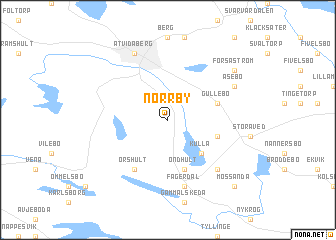
Norrby (Östergötland, Sweden)Norrby is a town in the Östergötland region of Sweden. An overview map of the region around Norrby is displayed below.
regional and 3d topo map of Norrby, Sweden ::
Norrby airports ::
The nearest airport is LPI - Linkoeping Saab, located 36.8 km north west of Norrby.
Other airports nearby include NRK - Norrkoeping Kungsangen (52.0 km north), HLF - Hultsfred (68.8 km south), NYO - Stockholm Skavsta (89.2 km north east), OSK - Oskarshamn (91.5 km south), Nearby towns ::
Kulla (4.2km south east) //
Mosshult (3.5km south east) //
Öndhult (5.6km south) //
Gullebo (3.5km north east) //
Örshult (5.9km south) //
Fagerdal (7.5km south) //
Ljungebo (6.3km south east) //
Åtvidaberg (7.7km north) //
Åsebo (5.4km north east) //
Forsaström (6.8km north east) //
Mossända (8.4km south east) //
[all distances 'as the bird flies' and approximate] 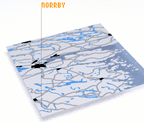 Places with similar names to Norrby, Sweden ::
Disclaimer :: Information on this page comes without warranty of any kind |
||
|
Where is Norrby? Elevation and coordinates ::
Latitude (lat): 58°8'0"N Longitude (lon): 16°2'0"E
Elevation (approx.): 113m (map arrows pan, magnifying glasses zoom) |
||
|
Visiting Norrby? Hotel/Accommodation ::
Book a hotel in Norrby Travel Guide ::
Buy a travel guide for Sweden rental cars ::
car rental offers GPS waypoint ::
download a GPX waypoint (PoI) of Norrby for your GPS receiver
|
||