|
search place name
|
||
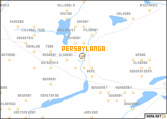
Persbylånga (Uppsala, Sweden)Persbylånga is a town in the Uppsala region of Sweden. An overview map of the region around Persbylånga is displayed below.
regional and 3d topo map of Persbylånga, Sweden ::
Persbylånga airports ::
The nearest airport is GVX - Gavle, located 56.9 km north west of Persbylånga.
Other airports nearby include ARN - Stockholm Arlanda (67.6 km south), VST - Vasteras (95.3 km south west), BMA - Stockholm Bromma (100.6 km south), NYO - Stockholm Skavsta (169.0 km south), Nearby towns ::
Tegelsmora (0.0km north) //
Källsby (0.0km north) //
Götby (1.9km north) //
Gyllby (1.9km south) //
Upplanda (2.1km south east) //
Örbyhus (2.1km south west) //
Broddby (2.1km north west) //
Prästarby (3.7km north) //
Elsarby (1.8km west) //
Bennarby (1.8km west) //
Berg (3.8km south) //
Sixarby (3.8km north) //
Filsarby (5.6km north) //
Såglandet (5.8km north) //
Göksby (7.4km north) //
Pesarby (3.7km west) //
Esarby (7.5km north) //
Tobo (4.1km north west) //
Österrike (4.1km south west) //
Bossarby (7.6km south) //
Bennarby (7.9km south) //
Bokarby (6.7km south west) //
[all distances 'as the bird flies' and approximate] 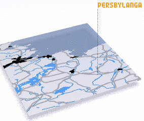 Places with similar names to Persbylånga, Sweden ::
// Presa Blanca (MX)
Disclaimer :: Information on this page comes without warranty of any kind |
||
|
Where is Persbylånga? Elevation and coordinates ::
Latitude (lat): 60°15'0"N Longitude (lon): 17°43'0"E
(map arrows pan, magnifying glasses zoom) |
||
|
Visiting Persbylånga? Hotel/Accommodation ::
Book a hotel in Persbylånga Travel Guide ::
Buy a travel guide for Sweden rental cars ::
car rental offers GPS waypoint ::
download a GPX waypoint (PoI) of Persbylånga for your GPS receiver
|
||