|
search place name
|
||
Rudeklint (Kalmar, Sweden)Rudeklint is a town in the Kalmar region of Sweden. An overview map of the region around Rudeklint is displayed below.
regional and 3d topo map of Rudeklint, Sweden ::

Rudeklint airports ::
The nearest airport is OSK - Oskarshamn, located 38.2 km south of Rudeklint.
Other airports nearby include HLF - Hultsfred (51.7 km west), LPI - Linkoeping Saab (98.1 km north west), VBY - Visby (102.1 km east), NRK - Norrkoeping Kungsangen (102.9 km north), Nearby towns ::
Lilla Nävelsvik (0.3km south east) //
Södra Tjust (1.0km south west) //
Bovassen (1.0km east) //
Ytterhult (2.0km north west) //
Muleglo (2.9km south) //
Berget (1.9km south west) //
Yxnevik (3.7km south west) //
Gutan (2.5km west) //
Nävelsö (2.8km east) //
Svallbo (3.5km north west) //
Vivastemåla (4.8km south west) //
Örbäcken (5.9km north) //
Grimsvik (3.6km east) //
Falkemåla (4.9km south west) //
Karlslund (5.6km south west) //
Kläcksvik (5.1km north west) //
Skaftet (5.0km south west) //
Strandbo (7.1km south) //
Västervik (7.2km north) //
Fermesbo (4.7km north west) //
Västrum (4.6km south west) //
Bråtviken (5.3km north east) //
Marsö (5.4km south east) //
Rödängen (4.3km east) //
Gruvan (4.5km east) //
Puksätter (5.5km north west) //
Äskestock (8.6km south) //
Flatholmen (8.1km south) //
[all distances 'as the bird flies' and approximate] 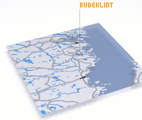 Places with similar names to Rudeklint, Sweden :: Disclaimer :: Information on this page comes without warranty of any kind |
||
|
Where is Rudeklint? Elevation and coordinates ::
Latitude (lat): 57°41'7"N Longitude (lon): 16°38'11"E
Elevation (approx.): 19m (map arrows pan, magnifying glasses zoom) |
||
|
Visiting Rudeklint? Hotel/Accommodation ::
Book a hotel in Rudeklint Travel Guide ::
Buy a travel guide for Sweden rental cars ::
car rental offers GPS waypoint ::
download a GPX waypoint (PoI) of Rudeklint for your GPS receiver
|
||