|
search place name
|
||
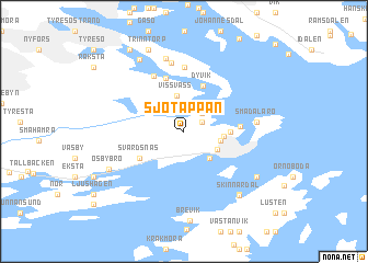
Sjötäppan (Stockholm, Sweden)Sjötäppan is a town in the Stockholm region of Sweden. An overview map of the region around Sjötäppan is displayed below.
regional and 3d topo map of Sjötäppan, Sweden ::
Sjötäppan airports ::
The nearest airport is BMA - Stockholm Bromma, located 33.3 km north west of Sjötäppan.
Other airports nearby include ARN - Stockholm Arlanda (61.0 km north west), NYO - Stockholm Skavsta (94.1 km south west), VST - Vasteras (110.4 km north west), MHQ - Mariehamn (137.3 km north east), Nearby towns ::
Älgholmen (1.4km north east) //
Styvnäset (2.1km north east) //
Dyviksudd (3.0km north) //
Vissvass (3.6km north) //
Dalarö (3.1km south east) //
Vadet (2.5km south east) //
Malmen (2.1km south east) //
Kolbotten (2.1km east) //
Tegelbruket (2.4km east) //
Dyvik (4.8km north) //
Svärdsnäs (3.6km south west) //
Ällmora (5.5km north) //
Furunäs (3.0km east) //
Noret (5.8km north) //
Brevik (6.5km north) //
Sjöberga (7.0km north) //
Smådalarö (3.9km east) //
Björndalen (7.5km north) //
Ösbybro (5.5km south west) //
Hammaren (7.1km south east) //
Tegelbruket (7.7km north) //
Skinnardal (7.1km south east) //
Orninge (6.0km south east) //
Trinntorp (8.6km north) //
Nytorp (8.8km north) //
[all distances 'as the bird flies' and approximate] 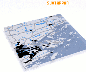 Places with similar names to Sjötäppan, Sweden :: Disclaimer :: Information on this page comes without warranty of any kind |
||
|
Where is Sjötäppan? Elevation and coordinates ::
Latitude (lat): 59°9'29"N Longitude (lon): 18°22'58"E
Elevation (approx.): 14m (map arrows pan, magnifying glasses zoom) |
||
|
Visiting Sjötäppan? Hotel/Accommodation ::
Book a hotel in Sjötäppan Travel Guide ::
Buy a travel guide for Sweden rental cars ::
car rental offers GPS waypoint ::
download a GPX waypoint (PoI) of Sjötäppan for your GPS receiver
|
||