|
search place name
|
||
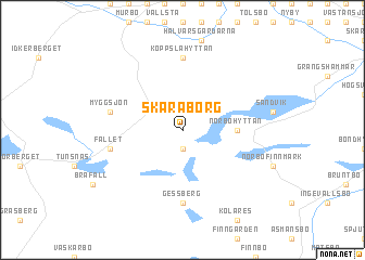
Skaraborg (Dalarna, Sweden)Skaraborg is a town in the Dalarna region of Sweden. An overview map of the region around Skaraborg is displayed below.
regional and 3d topo map of Skaraborg, Sweden ::
Skaraborg airports ::
The nearest airport is BLE - Borlange, located 14.3 km north east of Skaraborg.
Other airports nearby include MXX - Mora (85.4 km north west), GVX - Gavle (92.5 km east), VST - Vasteras (107.6 km south east), KSK - Karlskoga (118.7 km south west), Nearby towns ::
Ulvshyttan (1.9km south) //
Gyllingsberg (1.9km south) //
Skenshyttan (2.6km north east) //
Norbo (2.8km east) //
Norbohyttan (2.8km east) //
Koppslahyttan (7.4km north) //
Gessberg (7.4km south) //
Myggsjön (4.1km north west) //
Fallet (4.1km south west) //
[all distances 'as the bird flies' and approximate]  Places with similar names to Skaraborg, Sweden ::
// Schauerberg (DE)
// Schierbrok (DE)
// Scheuerberg (DE)
// Schreiberg (DE)
// Schraberg (DE)
// Schürberg (DE)
// Sucker Brook (US)
// Schauerberg (DE)
// Scharebrug (BE)
// Schoorbroek (BE)
Disclaimer :: Information on this page comes without warranty of any kind |
||
|
Where is Skaraborg? Elevation and coordinates ::
Latitude (lat): 60°19'0"N Longitude (lon): 15°22'0"E
(map arrows pan, magnifying glasses zoom) |
||
|
Visiting Skaraborg? Hotel/Accommodation ::
Book a hotel in Skaraborg Travel Guide ::
Buy a travel guide for Sweden rental cars ::
car rental offers GPS waypoint ::
download a GPX waypoint (PoI) of Skaraborg for your GPS receiver
|
||