|
search place name
|
||
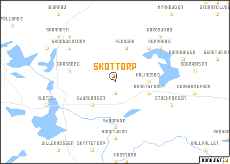
Skottorp (Dalarna, Sweden)Skottorp is a town in the Dalarna region of Sweden. An overview map of the region around Skottorp is displayed below.
regional and 3d topo map of Skottorp, Sweden ::
Skottorp airports ::
The nearest airport is BLE - Borlange, located 54.9 km north of Skottorp.
Other airports nearby include VST - Vasteras (80.0 km south east), ORB - Orebro (81.4 km south), KSK - Karlskoga (82.4 km south west), GVX - Gavle (113.8 km north east), Nearby towns ::
Sången (1.9km south) //
Djurlången (4.1km south west) //
Malingsbo (2.8km east) //
Bengtstorp (3.3km south east) //
Flängan (5.6km north) //
Sjöändan (7.4km south) //
Gräsberg (4.1km north west) //
Hedbyn (6.2km north east) //
Skräddartorp (6.7km north west) //
Kopparbo (6.7km north east) //
Söndagsbyn (8.3km north west) //
Gärdsjöbo (8.3km north east) //
[all distances 'as the bird flies' and approximate] 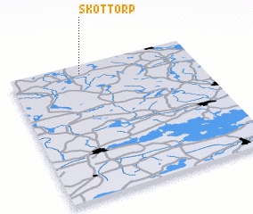 Places with similar names to Skottorp, Sweden ::
Disclaimer :: Information on this page comes without warranty of any kind |
||
|
Where is Skottorp? Elevation and coordinates ::
Latitude (lat): 59°56'0"N Longitude (lon): 15°23'0"E
Elevation (approx.): 265m (map arrows pan, magnifying glasses zoom) |
||
|
Visiting Skottorp? Hotel/Accommodation ::
Book a hotel in Skottorp Travel Guide ::
Buy a travel guide for Sweden rental cars ::
car rental offers GPS waypoint ::
download a GPX waypoint (PoI) of Skottorp for your GPS receiver
|
||