|
search place name
|
||
Södra Ängen (Värmland, Sweden)Södra Ängen is a town in the Värmland region of Sweden. An overview map of the region around Södra Ängen is displayed below.
regional and 3d topo map of Södra Ängen, Sweden ::

Södra Ängen airports ::
The nearest airport is OSL - Oslo Gardermoen, located 100.0 km west of Södra Ängen.
Other airports nearby include KSK - Karlskoga (113.7 km south east), MXX - Mora (153.0 km north east), LDK - Lidkoping (159.5 km south), KVB - Skovde (172.9 km south east), Nearby towns ::
Norra Ängen (0.0km north) //
Nässkogen (2.6km north east) //
Borrsjön (4.1km north east) //
Bjurbäcken (5.6km south) //
Ragvaldstjärn (5.6km north) //
Salungen (5.9km south) //
Humsjön (5.9km north) //
Brånändan (3.7km east) //
Kymmen (7.6km north) //
Stora Mången (6.7km north west) //
Långjohanstorp (6.7km south east) //
[all distances 'as the bird flies' and approximate] 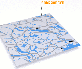 Places with similar names to Södra Ängen, Sweden ::
// Strengen (AT)
// Stahringen (DE)
// Störringen (DE)
// Strengen (NO)
// Stranjani (BA)
// Stranjani (BA)
// Satārno Ujan (PK)
// Strunjan (SI)
// Söderängen (SE)
// Storängen (SE)
Disclaimer :: Information on this page comes without warranty of any kind |
||
|
Where is Södra Ängen? Elevation and coordinates ::
Latitude (lat): 59°53'0"N Longitude (lon): 12°47'0"E
Elevation (approx.): 337m (map arrows pan, magnifying glasses zoom) |
||
|
Visiting Södra Ängen? Hotel/Accommodation ::
Book a hotel in Södra Ängen Travel Guide ::
Buy a travel guide for Sweden rental cars ::
car rental offers GPS waypoint ::
download a GPX waypoint (PoI) of Södra Ängen for your GPS receiver
|
||