|
search place name
|
||
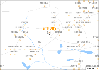
Stavby (Uppsala, Sweden)Stavby is a town in the Uppsala region of Sweden. An overview map of the region around Stavby is displayed below.
regional and 3d topo map of Stavby, Sweden ::
Stavby airports ::
The nearest airport is ARN - Stockholm Arlanda, located 38.8 km south of Stavby.
Other airports nearby include BMA - Stockholm Bromma (71.9 km south), GVX - Gavle (86.1 km north west), VST - Vasteras (86.9 km south west), MHQ - Mariehamn (109.4 km east), Nearby towns ::
Nyby (2.1km north east) //
Inninge (1.9km east) //
Mjölsta (2.6km north east) //
Väsby (3.8km north) //
Bärsta (3.8km north) //
Hov (4.1km south west) //
Skeberga (4.1km north east) //
Jönninge (4.1km north east) //
Ubby (5.6km north) //
Ströja (5.9km south) //
Vittja (4.1km north east) //
Lyan (7.5km north) //
Lejsta (6.2km south west) //
Skoby (5.2km north east) //
Rasbo (6.7km south west) //
Trävlinge (6.7km south west) //
Östersta (7.9km south) //
Fresta (8.3km north east) //
[all distances 'as the bird flies' and approximate] 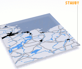
Disclaimer :: Information on this page comes without warranty of any kind |
||
|
Where is Stavby? Elevation and coordinates ::
Latitude (lat): 60°0'0"N Longitude (lon): 17°57'0"E
(map arrows pan, magnifying glasses zoom) |
||
|
Visiting Stavby? Hotel/Accommodation ::
Book a hotel in Stavby Travel Guide ::
Buy a travel guide for Sweden rental cars ::
car rental offers GPS waypoint ::
download a GPX waypoint (PoI) of Stavby for your GPS receiver
|
||