|
search place name
|
||
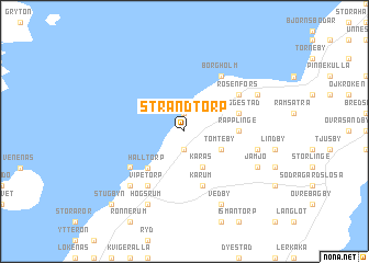
Strandtorp (Kalmar, Sweden)Strandtorp is a town in the Kalmar region of Sweden. An overview map of the region around Strandtorp is displayed below.
regional and 3d topo map of Strandtorp, Sweden ::
Strandtorp airports ::
The nearest airport is KLR - Kalkmar Kalmar, located 26.0 km south west of Strandtorp.
Other airports nearby include OSK - Oskarshamn (58.1 km north), HLF - Hultsfred (90.9 km north west), RNB - Ronneby (104.3 km south west), VXO - Vaxjo Kronoberg (115.6 km west), Nearby towns ::
Greby (1.8km south) //
Borgehage (1.9km north) //
Åketorp (3.8km south) //
Karås (3.8km south) //
Tomteby (2.7km south east) //
Halltorp (4.2km south west) //
Räpplinge (3.0km east) //
Äpplerum (3.0km east) //
Karum (5.6km south) //
Svarteberga (3.6km north east) //
Tryggestad (3.6km north east) //
Vipetorp (5.9km south) //
Ekerumshamn (4.8km south west) //
Rosenfors (4.8km north east) //
Borgholm (5.9km north) //
Ölands Lindby (4.4km south east) //
Rälla (6.3km south west) //
Vedby (7.7km south) //
Högsrum (7.7km south) //
Jämjö (5.5km south east) //
Kolstad (5.5km north east) //
Stugbyn (8.4km south west) //
[all distances 'as the bird flies' and approximate] 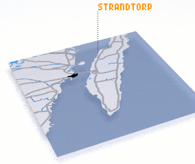 Places with similar names to Strandtorp, Sweden ::
// Strandtorp (SE)
// Strandtorp (SE)
Disclaimer :: Information on this page comes without warranty of any kind |
||
|
Where is Strandtorp? Elevation and coordinates ::
Latitude (lat): 56°49'59"N Longitude (lon): 16°37'0"E
Elevation (approx.): 43m (map arrows pan, magnifying glasses zoom) |
||
|
Visiting Strandtorp? Hotel/Accommodation ::
Book a hotel in Strandtorp Travel Guide ::
Buy a travel guide for Sweden rental cars ::
car rental offers GPS waypoint ::
download a GPX waypoint (PoI) of Strandtorp for your GPS receiver
|
||