|
search place name
|
||
Striberg (Örebro, Sweden)Striberg is a town in the Örebro region of Sweden. An overview map of the region around Striberg is displayed below.
regional and 3d topo map of Striberg, Sweden ::

Striberg airports ::
The nearest airport is KSK - Karlskoga, located 32.4 km south west of Striberg.
Other airports nearby include ORB - Orebro (35.0 km south), VST - Vasteras (96.3 km east), BLE - Borlange (104.2 km north), NRK - Norrkoeping Kungsangen (129.8 km south east), Nearby towns ::
Bastnäs (1.9km south) //
Fogdhyttan (2.1km south west) //
Åsboberg (1.9km east) //
Gyttorp (2.6km south east) //
Fåsjöhyttehäll (4.2km north east) //
Norra Ås (2.8km east) //
Skofttorp (2.8km east) //
Knapptorp (5.6km south) //
Blexberg (3.8km west) //
Bengtstorp (7.5km south) //
Kåfallstorp (7.5km north) //
Nor (5.3km south west) //
Nya Pershyttan (7.6km south) //
Klacka-Lerberg (7.6km north) //
Pershyttan (5.3km south east) //
Gamla Pershyttan (5.3km south east) //
Bondborn (5.3km north east) //
Gamla Viker (8.3km south west) //
[all distances 'as the bird flies' and approximate] 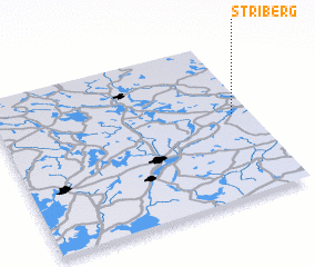 Places with similar names to Striberg, Sweden ::
// Staryy Borok (RU)
// Steuerberg (AT)
// Stierberg (AT)
// Stierberg (AT)
// Stierberg (AT)
// Cedarbrook (US)
// Zederberg (AT)
// Cedar Brook (US)
// Stierberg (DE)
// Stierberg (DE)
Disclaimer :: Information on this page comes without warranty of any kind |
||
|
Where is Striberg? Elevation and coordinates ::
Latitude (lat): 59°32'0"N Longitude (lon): 14°56'0"E
Elevation (approx.): 210m (map arrows pan, magnifying glasses zoom) |
||
|
Visiting Striberg? Hotel/Accommodation ::
Book a hotel in Striberg Travel Guide ::
Buy a travel guide for Sweden rental cars ::
car rental offers GPS waypoint ::
download a GPX waypoint (PoI) of Striberg for your GPS receiver
|
||