|
search place name
|
||
Svallet (Gävleborg, Sweden)Svallet is a town in the Gävleborg region of Sweden. An overview map of the region around Svallet is displayed below.
regional and 3d topo map of Svallet, Sweden ::
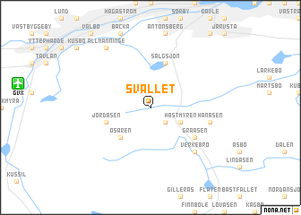
Svallet airports ::
The nearest airport is GVX - Gavle, located 8.7 km west of Svallet.
Other airports nearby include BLE - Borlange (88.6 km west), ARN - Stockholm Arlanda (111.6 km south east), VST - Vasteras (111.9 km south), HUV - Hudiksvall (133.9 km north), Nearby towns ::
Hästbo (2.1km south east) //
Hästmyren (2.6km south east) //
Ösaren (4.1km south west) //
Jordåsen (3.3km south west) //
Sälgsjön (5.6km north) //
Grååsen (4.6km south east) //
Hanåsen (4.1km south east) //
Verkebro (6.2km south east) //
Kessmansbo (6.2km south east) //
Allmänninge (7.9km north) //
[all distances 'as the bird flies' and approximate] 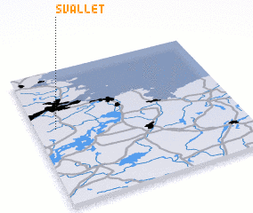 Places with similar names to Svallet, Sweden ::
Disclaimer :: Information on this page comes without warranty of any kind |
||
|
Where is Svallet? Elevation and coordinates ::
Latitude (lat): 60°34'0"N Longitude (lon): 17°6'0"E
(map arrows pan, magnifying glasses zoom) |
||
|
Visiting Svallet? Hotel/Accommodation ::
Book a hotel in Svallet Travel Guide ::
Buy a travel guide for Sweden rental cars ::
car rental offers GPS waypoint ::
download a GPX waypoint (PoI) of Svallet for your GPS receiver
|
||