|
search place name
|
||
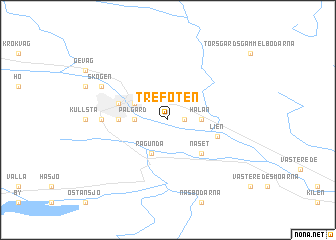
Trefoten (Jämtland, Sweden)Trefoten is a town in the Jämtland region of Sweden. An overview map of the region around Trefoten is displayed below.
regional and 3d topo map of Trefoten, Sweden ::
Trefoten airports ::
The nearest airport is KRF - Kramfors Solleftea, located 68.6 km east of Trefoten.
Other airports nearby include SDL - Sundsvall Harnosand (82.5 km south east), OSD - Ostersund Froson (97.1 km west), HUV - Hudiksvall (152.4 km south), EVG - Sveg (155.7 km south west), Nearby towns ::
Vågen (0.8km east) //
Halån (1.7km east) //
Pålgård (1.7km west) //
Ragunda (3.8km south) //
Torsgård (2.5km north west) //
Näset (4.1km south east) //
Kånkback (2.5km west) //
Gisselgård (3.1km north west) //
Lien (3.1km south east) //
Hammarstrand (3.4km west) //
Skogen (5.0km north west) //
[all distances 'as the bird flies' and approximate]  Places with similar names to Trefoten, Sweden ::
// Drifton (US)
// Drifton (US)
// Trováton (GR)
// Trovatn (NO)
// Tervydoniai (LT)
// Drvetine (BA)
// Tervidāni (LV)
// Drevedeni (RO)
// Drifton (US)
// Tiruvādānai (IN)
Disclaimer :: Information on this page comes without warranty of any kind |
||
|
Where is Trefoten? Elevation and coordinates ::
Latitude (lat): 63°6'0"N Longitude (lon): 16°25'0"E
(map arrows pan, magnifying glasses zoom) |
||
|
Visiting Trefoten? Hotel/Accommodation ::
Book a hotel in Trefoten Travel Guide ::
Buy a travel guide for Sweden rental cars ::
car rental offers GPS waypoint ::
download a GPX waypoint (PoI) of Trefoten for your GPS receiver
|
||