|
search place name
|
||
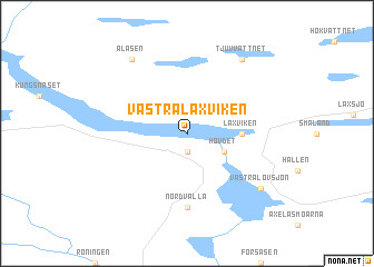
Västra Laxviken (Jämtland, Sweden)Västra Laxviken is a town in the Jämtland region of Sweden. An overview map of the region around Västra Laxviken is displayed below.
regional and 3d topo map of Västra Laxviken, Sweden ::
Västra Laxviken airports ::
The nearest airport is OSD - Ostersund Froson, located 67.9 km south of Västra Laxviken.
Other airports nearby include EVG - Sveg (195.6 km south), MJF - Mosjoen Kjaerstad (231.5 km north), Nearby towns ::
Mörtsjön (1.9km south) //
Hovdet (2.5km south east) //
Laxviken (2.5km east) //
Nordvalla (7.4km south) //
Lövsjön (6.5km south east) //
Västra Lövsjön (6.5km south east) //
Tjuvvattnet (7.8km north) //
Ålåsen (7.8km north) //
[all distances 'as the bird flies' and approximate] 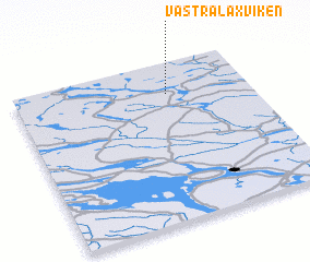 Places with similar names to Västra Laxviken, Sweden :: Disclaimer :: Information on this page comes without warranty of any kind |
||
|
Where is Västra Laxviken? Elevation and coordinates ::
Latitude (lat): 63°48'0"N Longitude (lon): 14°39'0"E
(map arrows pan, magnifying glasses zoom) |
||
|
Visiting Västra Laxviken? Hotel/Accommodation ::
Book a hotel in Västra Laxviken Travel Guide ::
Buy a travel guide for Sweden rental cars ::
car rental offers GPS waypoint ::
download a GPX waypoint (PoI) of Västra Laxviken for your GPS receiver
|
||