|
search place name
|
||
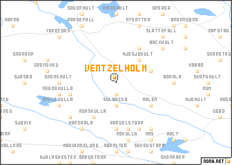
Ventzelholm (Kalmar, Sweden)Ventzelholm is a town in the Kalmar region of Sweden. An overview map of the region around Ventzelholm is displayed below.
regional and 3d topo map of Ventzelholm, Sweden ::
Ventzelholm airports ::
The nearest airport is HLF - Hultsfred, located 24.6 km south east of Ventzelholm.
Other airports nearby include OSK - Oskarshamn (66.7 km south east), LPI - Linkoeping Saab (76.9 km north), JKG - Joenkoeping Jonkoping (92.3 km west), VXO - Vaxjo Kronoberg (102.8 km south west), Nearby towns ::
Edserum (1.9km south) //
Södra Kvill (2.1km north east) //
Solbacka (3.7km south) //
Mjösjöhult (4.2km north east) //
Skräddarefall (3.5km north east) //
Norrlid (3.5km north east) //
Lindefall (5.9km north) //
Rumskulla (5.9km south) //
Brånhult (4.8km south east) //
Målen (4.8km south east) //
Mossåkra (7.4km south) //
Hult (7.4km south) //
Rangelstorp (7.5km south) //
Övrakulla (4.4km south west) //
Gibberyd (4.4km south west) //
Fiefall (7.7km south) //
Bäckhult (6.8km north east) //
Källeberg (6.8km south west) //
Kåremåla (8.0km south) //
Holmsjökull (8.0km south) //
Tjurstorp (8.0km south) //
Slättefall (8.4km north east) //
[all distances 'as the bird flies' and approximate] 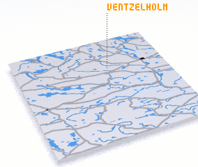 Places with similar names to Ventzelholm, Sweden :: Disclaimer :: Information on this page comes without warranty of any kind |
||
|
Where is Ventzelholm? Elevation and coordinates ::
Latitude (lat): 57°43'0"N Longitude (lon): 15°37'0"E
Elevation (approx.): 143m (map arrows pan, magnifying glasses zoom) |
||
|
Visiting Ventzelholm? Hotel/Accommodation ::
Book a hotel in Ventzelholm Travel Guide ::
Buy a travel guide for Sweden rental cars ::
car rental offers GPS waypoint ::
download a GPX waypoint (PoI) of Ventzelholm for your GPS receiver
|
||