|
search place name
|
||
Vindeln (Västerbotten, Sweden)Vindeln is a town in the Västerbotten region of Sweden. An overview map of the region around Vindeln is displayed below.
regional and 3d topo map of Vindeln, Sweden ::

Vindeln airports ::
The nearest airport is UME - Umea, located 52.9 km south east of Vindeln.
Other airports nearby include LYC - Lycksele (62.6 km north west), SFT - Skelleftea (80.2 km north east), OER - Ornskoldsvik (95.5 km south west), AJR - Arvidsjaur (156.5 km north), Nearby towns ::
Degerfors (0.8km west) //
Flakabäck (0.8km east) //
Rosinedal (1.9km south) //
Renfors (2.0km north west) //
Abborrtjärn (3.7km north) //
Västomån (1.6km west) //
Sunnansjönäs (7.5km south) //
Degerås (6.1km south west) //
Granåker (4.9km north west) //
Degerön (4.9km south west) //
[all distances 'as the bird flies' and approximate] 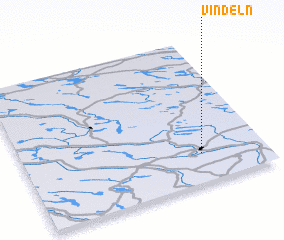 Places with similar names to Vindeln, Sweden ::
// Vintelen (DE)
// Fond Duline (HT)
// Fond Liane (HT)
// Vendelín (CZ)
// Vendelín (CZ)
// Fondelin (FR)
// Font Léon (FR)
// Vondelen (BE)
// Foundoulianá (GR)
Disclaimer :: Information on this page comes without warranty of any kind |
||
|
Where is Vindeln? Elevation and coordinates ::
Latitude (lat): 64°12'0"N Longitude (lon): 19°44'0"E
(map arrows pan, magnifying glasses zoom) |
||
|
Visiting Vindeln? Hotel/Accommodation ::
Book a hotel in Vindeln Travel Guide ::
Buy a travel guide for Sweden rental cars ::
car rental offers GPS waypoint ::
download a GPX waypoint (PoI) of Vindeln for your GPS receiver
|
||