|
search place name
|
||
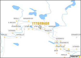
Ytteråker (Dalarna, Sweden)Ytteråker is a town in the Dalarna region of Sweden. An overview map of the region around Ytteråker is displayed below.
regional and 3d topo map of Ytteråker, Sweden ::
Ytteråker airports ::
The nearest airport is MXX - Mora, located 47.7 km north of Ytteråker.
Other airports nearby include BLE - Borlange (62.6 km east), KSK - Karlskoga (132.4 km south), ORB - Orebro (150.2 km south), EVG - Sveg (168.8 km north), Nearby towns ::
Kvarnåker (0.0km north) //
Snöborg (0.9km east) //
Utby (0.9km west) //
Noret (2.1km north east) //
Järna (1.8km west) //
Högosta (2.6km south east) //
Myrbacka (2.6km north west) //
Snöåbyn (2.7km east) //
Utsälje (2.7km west) //
Grånäs (2.7km west) //
Dala-Järna (3.3km north west) //
Nordanåker (4.6km north west) //
Morn (3.6km west) //
Malmsta (6.7km south east) //
Tyna (8.3km south east) //
[all distances 'as the bird flies' and approximate]  Places with similar names to Ytteråker, Sweden ::
// Toracari (BO)
// Tríkeri (GR)
// Törökér (HU)
// Torreagüera (ES)
// Traiguera (ES)
// Taurikura (NZ)
// Traquair (NZ)
// Dar-e Gūrū (IR)
// Dar-e Kerū (IR)
// Dar Gūr (IR)
Disclaimer :: Information on this page comes without warranty of any kind |
||
|
Where is Ytteråker? Elevation and coordinates ::
Latitude (lat): 60°32'0"N Longitude (lon): 14°24'0"E
(map arrows pan, magnifying glasses zoom) |
||
|
Visiting Ytteråker? Hotel/Accommodation ::
Book a hotel in Ytteråker Travel Guide ::
Buy a travel guide for Sweden rental cars ::
car rental offers GPS waypoint ::
download a GPX waypoint (PoI) of Ytteråker for your GPS receiver
|
||