|
search place name
|
||
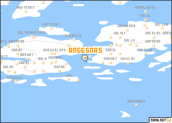
Angesnäs (Länsi-Suomen Lääni, Finland)Angesnäs is a town in the Länsi-Suomen Lääni region of Finland. An overview map of the region around Angesnäs is displayed below.
regional and 3d topo map of Angesnäs, Finland ::
Angesnäs airports ::
The nearest airport is TKU - Turku, located 52.4 km north east of Angesnäs.
Other airports nearby include MHQ - Mariehamn (100.2 km west), POR - Pori (147.9 km north), TMP - Tampere Pirkkala (176.3 km north east), Nearby towns ::
Djupdal (1.0km north east) //
Krok (1.8km east) //
Almas (2.2km west) //
Sandvik (4.2km south) //
Västerretais (4.0km north west) //
Österretais (4.0km north west) //
Lom (4.3km south west) //
Krokby (2.7km east) //
Björklid (4.9km north) //
Såris (3.2km north east) //
Rumar (3.5km south west) //
Strandby (4.5km north east) //
Inikorp (3.3km west) //
Svedjelund (3.7km north west) //
Bisarbole (4.9km north east) //
Syvälax (3.7km west) //
Risis (4.0km north east) //
Sydänperä (6.0km north east) //
Rosklax (4.1km north west) //
Antböle (5.1km north east) //
Koum (5.1km north east) //
Jälist (6.5km north east) //
Vattkast (8.1km north west) //
Sexnappa (8.2km north east) //
[all distances 'as the bird flies' and approximate] 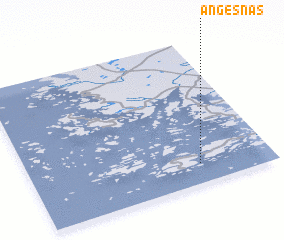 Places with similar names to Angesnäs, Finland :: Disclaimer :: Information on this page comes without warranty of any kind |
||
|
Where is Angesnäs? Elevation and coordinates ::
Latitude (lat): 60°8'6"N Longitude (lon): 21°42'3"E
(map arrows pan, magnifying glasses zoom) |
||
|
Visiting Angesnäs? Hotel/Accommodation ::
Book a hotel in Angesnäs Travel Guide ::
Buy a travel guide for Finland rental cars ::
car rental offers GPS waypoint ::
download a GPX waypoint (PoI) of Angesnäs for your GPS receiver
|
||