|
search place name
|
||
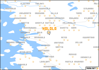
Halola (Länsi-Suomen Lääni, Finland)Halola is a town in the Länsi-Suomen Lääni region of Finland. An overview map of the region around Halola is displayed below.
regional and 3d topo map of Halola, Finland ::
Halola airports ::
The nearest airport is TKU - Turku, located 52.1 km south east of Halola.
Other airports nearby include POR - Pori (77.5 km north), MHQ - Mariehamn (114.2 km south west), Nearby towns ::
Sanno (2.1km north west) //
Salmi (1.8km west) //
Hakametsä (1.8km west) //
Siuttula (3.7km north) //
Orivo (3.7km north) //
Arvassalo (2.6km south west) //
Ruonanperä (3.8km north) //
Alsila (3.8km north) //
Kytämäki (4.9km south) //
Vahterus (4.2km south east) //
Uusikylä (4.1km north west) //
Tynki (5.6km north) //
Uussaari (5.6km north) //
Ridanala (5.6km north) //
Petes (3.3km south east) //
Siivottu (3.3km north east) //
Kaivola (5.6km north) //
Siivola (5.6km north) //
Ruokola (3.3km north west) //
Taipale (6.0km south) //
Sannainen (5.8km north) //
Santtio (5.8km south) //
Lahti (3.9km south east) //
Väättäinen (6.9km south) //
Kaukola (7.4km north) //
Uusikaupunki (4.1km north west) //
Jokisivu (7.5km north) //
Haudonsaari (7.5km north) //
Hakoinen (7.5km north) //
[all distances 'as the bird flies' and approximate] 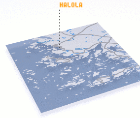 Places with similar names to Halola, Finland ::
Disclaimer :: Information on this page comes without warranty of any kind |
||
|
Where is Halola? Elevation and coordinates ::
Latitude (lat): 60°47'0"N Longitude (lon): 21°29'0"E
(map arrows pan, magnifying glasses zoom) |
||
|
Visiting Halola? Hotel/Accommodation ::
Book a hotel in Halola Travel Guide ::
Buy a travel guide for Finland rental cars ::
car rental offers GPS waypoint ::
download a GPX waypoint (PoI) of Halola for your GPS receiver
|
||