|
search place name
|
||
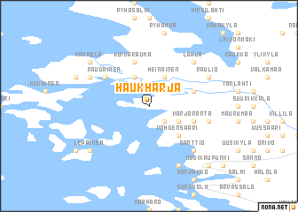
Haukharja (Länsi-Suomen Lääni, Finland)Haukharja is a town in the Länsi-Suomen Lääni region of Finland. An overview map of the region around Haukharja is displayed below.
regional and 3d topo map of Haukharja, Finland ::
Haukharja airports ::
The nearest airport is TKU - Turku, located 63.5 km south east of Haukharja.
Other airports nearby include POR - Pori (70.6 km north), MHQ - Mariehamn (115.1 km south west), Nearby towns ::
Okslanpää (2.1km south east) //
Heinäinen (3.8km north) //
Kursila (3.8km north) //
Pyrrilä (2.6km south east) //
Louko (2.6km south east) //
Vohdensaari (4.1km south east) //
Elkkynen (3.3km north east) //
Kuivarauma (5.6km north) //
Varjoranta (3.3km south east) //
Raudainen (4.6km north west) //
Kingo (4.1km south east) //
Laaja (6.2km north east) //
Saarnisto (6.2km south east) //
Santtio (6.2km south east) //
Hiu (6.2km south east) //
Raulio (5.2km north east) //
Kamminkari (5.2km north west) //
Pietola (7.6km south) //
Kammela (6.6km north west) //
Lepäinen (6.6km south west) //
Uusikaupunki (8.2km south east) //
[all distances 'as the bird flies' and approximate] 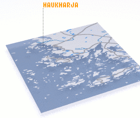 Places with similar names to Haukharja, Finland ::
// Hiekkaharju (FI)
Disclaimer :: Information on this page comes without warranty of any kind |
||
|
Where is Haukharja? Elevation and coordinates ::
Latitude (lat): 60°52'0"N Longitude (lon): 21°21'0"E
(map arrows pan, magnifying glasses zoom) |
||
|
Visiting Haukharja? Hotel/Accommodation ::
Book a hotel in Haukharja Travel Guide ::
Buy a travel guide for Finland rental cars ::
car rental offers GPS waypoint ::
download a GPX waypoint (PoI) of Haukharja for your GPS receiver
|
||