|
search place name
|
||
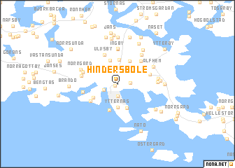
Hindersböle (Ahvenanmaa, Finland)Hindersböle is a town in the Ahvenanmaa region of Finland. An overview map of the region around Hindersböle is displayed below.
regional and 3d topo map of Hindersböle, Finland ::
Hindersböle airports ::
The nearest airport is MHQ - Mariehamn, located 2.9 km west of Hindersböle.
Other airports nearby include POR - Pori (180.6 km north east), Nearby towns ::
Strandnäs (0.3km south west) //
Dalkarby (1.9km north) //
Maarianhamina (1.9km south) //
Mariehamn (1.9km south) //
Kalmsta (1.0km east) //
Klinten (1.4km south west) //
Västerkalmare (2.1km north east) //
Ytternäs (3.7km south) //
Kyrkobyn (3.9km north) //
Möckelby (3.8km north) //
Grönbacka (2.9km north east) //
Östra Ytternäs (3.8km south) //
Jättböle (2.6km north east) //
Jomala (3.8km north) //
Västra Ytternäs (4.2km south) //
Rommarn (2.9km south west) //
Ulvsby (4.8km north) //
Trovill (3.5km south west) //
Överby (4.1km north east) //
Österkalmare (3.0km north east) //
Ingby (5.6km north) //
Norrgård (3.0km south west) //
Markusas (5.7km north) //
Torp (3.3km north west) //
Boskas (3.4km north west) //
Kihla (5.0km north) //
Julle (3.2km north west) //
Norrgård (3.7km north west) //
Jonases (3.2km east) //
[all distances 'as the bird flies' and approximate] 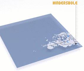 Places with similar names to Hindersböle, Finland :: Disclaimer :: Information on this page comes without warranty of any kind |
||
|
Where is Hindersböle? Elevation and coordinates ::
Latitude (lat): 60°7'0"N Longitude (lon): 19°57'0"E
(map arrows pan, magnifying glasses zoom) |
||
|
Visiting Hindersböle? Hotel/Accommodation ::
Book a hotel in Hindersböle Travel Guide ::
Buy a travel guide for Finland rental cars ::
car rental offers GPS waypoint ::
download a GPX waypoint (PoI) of Hindersböle for your GPS receiver
|
||