|
search place name
|
||
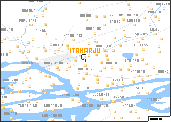
Itäharju (Länsi-Suomen Lääni, Finland)Itäharju is a town in the Länsi-Suomen Lääni region of Finland. An overview map of the region around Itäharju is displayed below.
regional and 3d topo map of Itäharju, Finland ::
Itäharju airports ::
The nearest airport is TKU - Turku, located 8.1 km north of Itäharju.
Other airports nearby include POR - Pori (116.6 km north), TMP - Tampere Pirkkala (128.7 km north east), Nearby towns ::
Vasaramäki (0.9km south) //
Nummi (1.3km north) //
Kupitaa (1.1km west) //
Kurala (1.8km north east) //
Koivula (2.7km south) //
Halinen (2.6km north) //
Peltola (2.5km south) //
Koroinen (2.5km north) //
Räntämäki (3.1km north) //
Turku (1.7km west) //
Åbo (1.7km west) //
Pääskyvuori (1.7km east) //
Harittu (3.8km south) //
Mäntymäki (2.2km south west) //
Kohmo (2.4km north east) //
Huhkola (2.7km south east) //
Poikluoma (3.4km south) //
Oriketo (3.9km north) //
Raunistula (2.7km north west) //
Lauste (2.5km south east) //
Luolavuori (2.7km south west) //
Ilpoinen (3.6km south west) //
Kastu (3.3km north west) //
Piispanristi (4.2km south) //
Kultanummi (2.6km north east) //
Kausela (3.1km north east) //
Ilmarinen (4.3km north) //
Katariina (4.3km south) //
Varissuo (2.4km east) //
[all distances 'as the bird flies' and approximate] 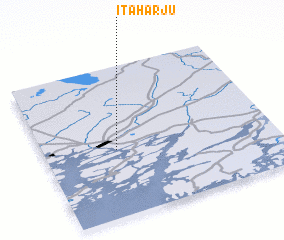 Places with similar names to Itäharju, Finland :: Disclaimer :: Information on this page comes without warranty of any kind |
||
|
Where is Itäharju? Elevation and coordinates ::
Latitude (lat): 60°26'44"N Longitude (lon): 22°18'46"E
(map arrows pan, magnifying glasses zoom) |
||
|
Visiting Itäharju? Hotel/Accommodation ::
Book a hotel in Itäharju Travel Guide ::
Buy a travel guide for Finland rental cars ::
car rental offers GPS waypoint ::
download a GPX waypoint (PoI) of Itäharju for your GPS receiver
|
||