|
search place name
|
||
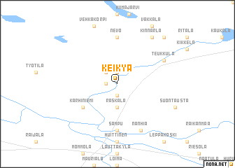
Keikyä (Länsi-Suomen Lääni, Finland)Keikyä is a town in the Länsi-Suomen Lääni region of Finland. An overview map of the region around Keikyä is displayed below.
regional and 3d topo map of Keikyä, Finland ::
Keikyä airports ::
The nearest airport is TMP - Tampere Pirkkala, located 51.1 km east of Keikyä.
Other airports nearby include POR - Pori (52.8 km north west), TKU - Turku (87.1 km south), VAA - Vaasa (204.7 km north), KAU - Kauhava (208.1 km north), Nearby towns ::
Pehula (1.9km north) //
Aarikkala (0.9km west) //
Kiviniemi (1.9km south) //
Äetsä (2.1km north west) //
Honkola (2.1km north west) //
Raskala (3.7km south) //
Karhiniemi (4.6km south west) //
Nevo (7.4km north) //
Sampu (7.4km south) //
Teukkula (5.1km north east) //
Kilpijoki (5.1km north east) //
Nanhia (7.6km south) //
Kinnarla (7.9km north) //
Kiikka (8.2km north east) //
[all distances 'as the bird flies' and approximate] 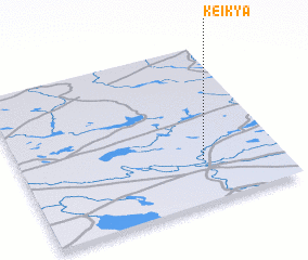 Places with similar names to Keikyä, Finland ::
Disclaimer :: Information on this page comes without warranty of any kind |
||
|
Where is Keikyä? Elevation and coordinates ::
Latitude (lat): 61°16'0"N Longitude (lon): 22°42'0"E
(map arrows pan, magnifying glasses zoom) |
||
|
Visiting Keikyä? Hotel/Accommodation ::
Book a hotel in Keikyä Travel Guide ::
Buy a travel guide for Finland rental cars ::
car rental offers GPS waypoint ::
download a GPX waypoint (PoI) of Keikyä for your GPS receiver
|
||